
4 PM WEATHER 7-30-26
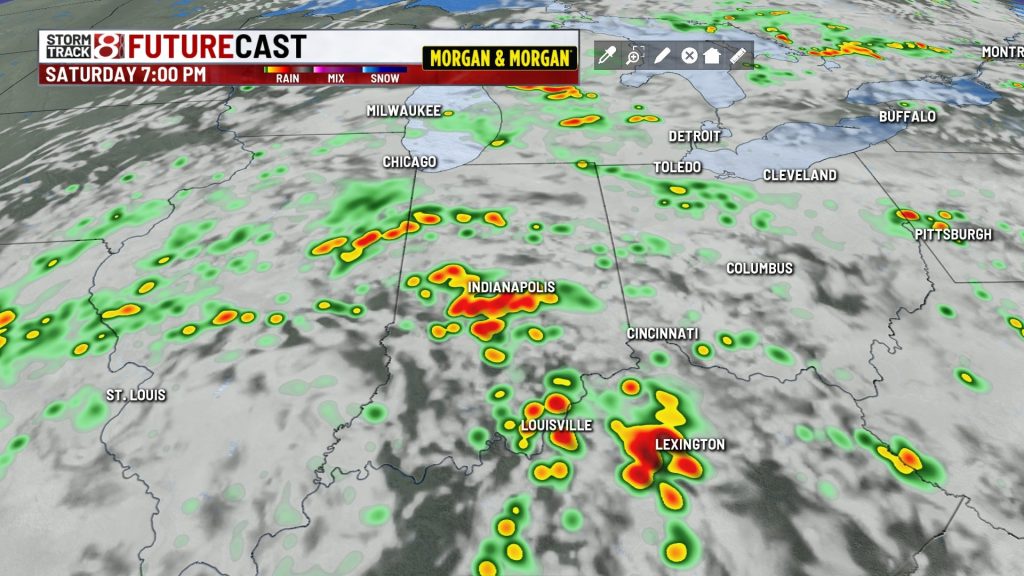
INDIANAPOLIS (WISH) — Rain & storms return late Friday into Saturday. Some rain may be heavy and there is a low severe weather risk.
THURSDAY NIGHT:
Fair skies and quiet. Lows mainly in the 60s.

FRIDAY:
Increasing clouds with a chance of a little rain and/or thunder by late afternoon or evening. Seasonably warm highs in the mid 80s.


FRIDAY NIGHT:
Mostly cloudy with scattered rain & storms possible. Warmer lows in the upper 60s.
SATURDAY:
Scattered rain & storms. Some rain may be locally heavy and lead to flooding.


There is also a non-zero chance of a strong/severe storm across eastern or southeastern Indiana that could produce gusty winds or a brief spin-up tornado.

This all depends on how unstable the atmosphere can become in the afternoon. Highs in the mid to upper 70s are expected in most spots.
SUNDAY:
The chance of rain & storms will continue, but odds will be lower than the first half of the weekend. Highs in the upper 70s to around 80 are likely.
NEXT WEEK:
Temperatures are going to warm back into the 80s, with upper 80s becoming the norm by the end of the week. Some spotty rain/storms could return to the region Tuesday onward. No major weather event is on our radar screen, at least at this point, as we lead up to the Indiana State Fair on Friday, August 7th.

About The Author

You may also like
-
Fever GM defends fans, says criticism has ‘no basis in reality’
-
‘Person shot’ report at Warren Central High School on football night
-
Grand jury indicts 35-year-old man in 2006 Franklin murders case
-
Cat food investigation finds heavy metals, pesticides and plastic chemicals
-
A cold front brings rain, falling temperatures Friday | Oct. 2 , 2026