
Marcus’ 4 a.m. Monday forecast
INDIANAPOLIS (WISH) — After a cool start to May, we’re returning to classic spring weather. Warm and stormy conditions are expected today, followed by a cool and rainy stretch for much of this week.
Enjoy the warmth while it lasts!
Noticeably mild temperatures this afternoon, with highs climbing into the low to mid 70s — well above average for this time of year.

Scattered showers and isolated thunderstorms are likely to develop, especially across the southern two-thirds of the state. There is a low-end threat for a couple of gusty storms and hail producers, particularly over the northern half of the state, which is under a Level 1 out of 5 risk for severe storms.

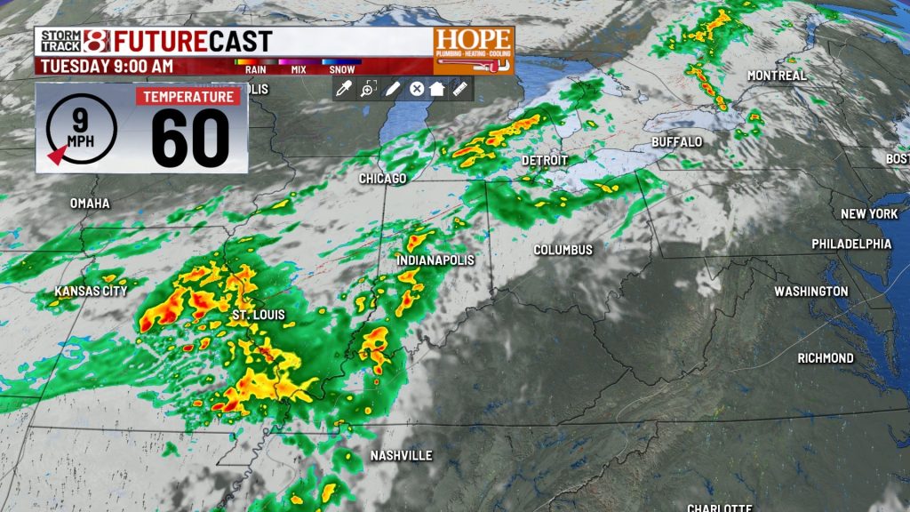
Cold front brings rain and a cool-down.
A big shift arrives on Tuesday as a cold front swings across Central Indiana. This will bring widespread rain, which is expected to be heavy at times during the afternoon and evening hours.


Temperatures will run much cooler, with highs only in the lower 60s.
Below-normal temperatures and unsettled weather will continue.
Don’t expect a quick rebound this week. An upper-level low will linger over the eastern U.S., keeping us cool and bringing spotty rain chances, especially Wednesday morning.
Thursday should be a dry day as high pressure briefly settles in, though it will remain cool with highs only in the upper 50s.
Much of Friday will be dry, but a weak system moving in Friday night could bring spotty rain chances.
The weekend looks relatively quiet but below average, with high temperatures only in the mid to upper 60s.

About The Author
You may also like
-
Man critically injured in shooting outside restaurant near Castleton Square Mall
-
Clinton County sheriff faces gun charge following incident at Jim Irsay’s former home
-
IMPD: Person shot in vicinity of East Washington Street gas station
-
Multiple people shot, 2 fatally, in separate incidents on Indy’s north, west sides
-
2026 Legends Day concert canceled, IMS officials confirm