
Marcus’ 4 a.m. Friday forecast
INDIANAPOLIS (WISH) — Northern and central Indiana faces a flash flood threat this morning. Dangerous heat builds into the weekend before a pattern shift brings relief early next week.
This Morning: Flash Flood Threat and Severe Storms at Dawn
Northern-central Indiana, including areas near the I-70 corridor, faces a significant flash flood threat through the morning hours. Heavy rain rates combined with saturated soils raise concerns for rapid runoff and localized flooding.
High precipitation potential will support training storms, where multiple cells move over the same areas, leading to excessive rainfall totals.
Today: Hot Temperatures and Heat Index Concerns
Highs will vary across the region. Expect lower 80s in the northeast counties such as Delaware and Blackford, climbing into the lower 90s southwest toward Vanderburgh and Posey counties.
Heat index values will top 100 degrees in southwestern Indiana due to high humidity.
Tonight: Storm Chances Continue
Storm chances persist into the evening and overnight, especially along and north of the I-70 corridor. Although the severe threat diminishes, moderate to heavy downpours with gusty winds remain possible.
Overnight lows will remain muggy, in the low to mid-70s across much of central Indiana.
Tomorrow (Saturday): High Heat Builds
A warm front combined with increasing humidity will push heat index values up to 105 degrees across southwestern Indiana.
High temperatures will reach the low to mid-90s statewide, with the hottest readings in areas south and west of Indianapolis.
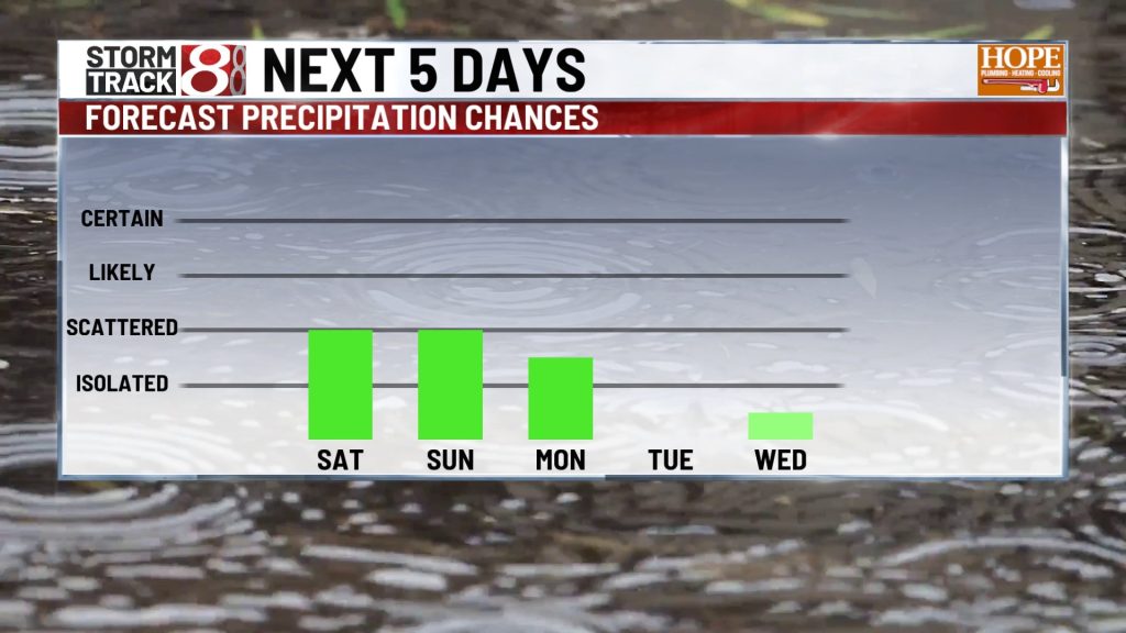
Isolated severe storms are possible Saturday afternoon during peak heating hours and again overnight.
Weekend Into Early Next Week: Lingering Storm Chance Before Cooler, Drier Air Arrives
Storm chances will continue through Sunday, driven by an upper-level wave moving across the region. Expect scattered showers and thunderstorms through the weekend.
By Monday and Tuesday, a cold front will usher in cooler, drier air, bringing relief from heat and humidity with highs dropping into the low to mid-80s and lower humidity.
7-Day Outlook
About The Author

You may also like
-
Hamilton County Commissioners declare State of Emergency amid flooding
-
Cleanup begins in New Castle after historic flooding
-
Mean dies after being struck by a vehicle east of downtown Indianapolis
-
Chicago Bears announce ‘sole focus’ to build ‘world-class stadium’ in Hammond
-
3 people rescued, 4th still missing from flooding on Mississinewa River