
Marcus’ 4 a.m. Thursday forecast
INDIANAPOLIS (WISH) — Thursday, Aug. 13, 2026, brings a complex weather scenario to Central Indiana with multiple hazards expected throughout the day.
This morning:
A Dense Fog Advisory remains in effect until 9 a.m. for areas along and north of Interstate 70. Visibility will frequently drop below a quarter mile for many locations – especially low lying areas.
Today:
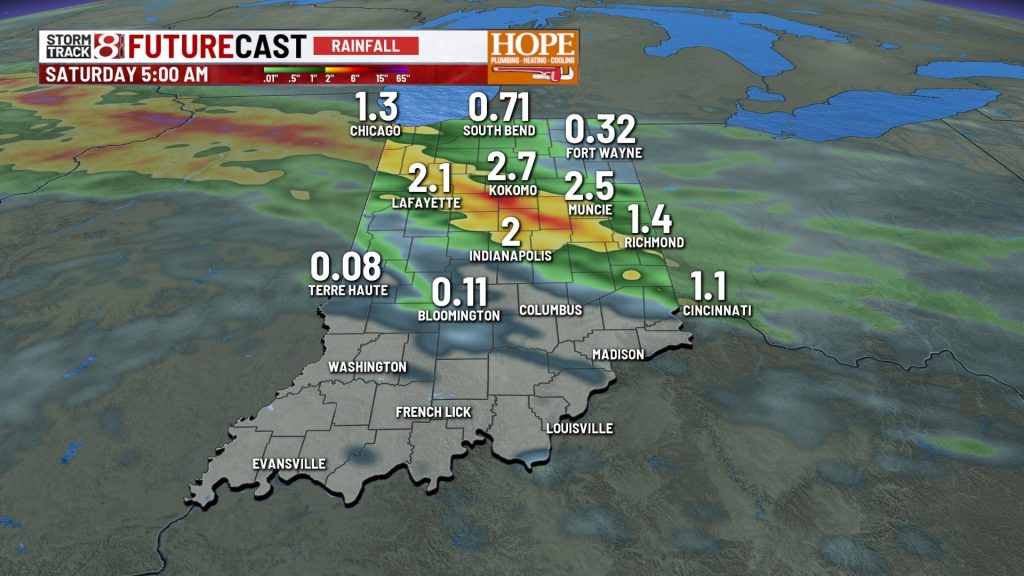
The primary weather concern shifts to heavy rainfall and flooding. There is a ton of moisture in the air again today – and the with a similar storm track to previous days – more heavy downpours are likely over flooded areas.
Widespread rain totals will range from 1 to 2.5 inches, with localized amounts of 3 to 6 inches possible, particularly along and near the Interstate 74 corridor. A Flood Watch is in effect for most of central Indiana.

A line of storms advancing from the west may produce damaging wind gusts this afternoon through evening. While severe weather is not expected to be widespread, isolated wind gusts reaching 60 mph or higher are possible within organized storm cells.

The primary window for severe weather will be between 2 p.m. and 10 p.m.
High temperatures will reach the upper 80s.
Tonight:
Rainfall is expected to continue into the overnight hours before tapering off. Some areas may experience brief periods of localized flooding, especially where heavy rain accumulates. Rainfall rates could reach 2 inches per hour during the peak intensity.
Overnight lows will remain muggy in the low to mid-70s.
Tomorrow:
The active weather pattern persists, with additional shower and thunderstorm chances on Friday and Saturday.
Temperatures will rise into the upper 80s to low 90s by Saturday, with heat indices approaching 100 degrees in southern counties.
7-day forecast:
A cold front is forecast to bring drier, cooler air starting Monday. Look for more comfortable conditions to settle in through the middle of next week with lower humidity and temperatures closer to seasonal norms.

About The Author
