
Interactive radar | Latest forecast | Download the WISH-TV weather app
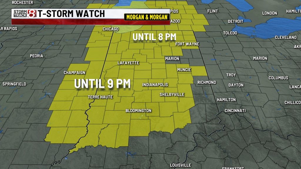
(WISH) — The National Weather Service Storm Prediction Center has issued a severe thunderstorm watch for much of central Indiana through 9 p.m. Monday,
An intensifying cluster of thunderstorms over northwest Indiana was forecast to move southward through a moist and unstable air mass, creating favorable conditions for severe weather across a large portion of the state Monday afternoon and evening.
Primary threats are widespread damaging winds with isolated gusts up to 80 mph, large hail up to 2 inches in diameter, and a tornado or two.
The following 39 Indiana counties are under this watch: Bartholomew, Boone, Brown, Carroll, Clay, Clinton, Daviess, Decatur, Delaware, Fountain, Greene, Hamilton, Hancock, Hendricks, Henry, Howard, Jackson, Jennings, Johnson, Knox, Lawrence, Madison, Marion, Martin, Monroe, Montgomery, Morgan, Owen, Parke, Putnam, Randolph, Rush, Shelby, Sullivan, Tippecanoe, Tipton, Vermillion, Vigo, Warren.
A separate storm watch is in effect for much of northern Indiana until 8 p.m. Monday.
A storm watch means conditions are favorable for severe thunderstorms.
About The Author

You may also like
-
Fever GM defends fans, says criticism has ‘no basis in reality’
-
‘Person shot’ report at Warren Central High School on football night
-
Grand jury indicts 35-year-old man in 2006 Franklin murders case
-
Cat food investigation finds heavy metals, pesticides and plastic chemicals
-
A cold front brings rain, falling temperatures Friday | Oct. 2 , 2026