
Heavy rain & strong storms will exit tonight. More rain is possible Tuesday night and Wednesday morning with much cooler weather later in the week.
A ***Flood Watch*** remains in effect until 2 AM Tuesday.

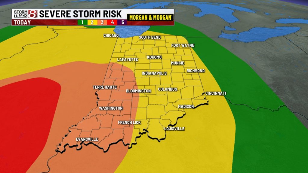
MONDAY EVENING/NIGHT:
Strong to severe storms with heavy rain will move south after midnight. Storms during the evening could produce damaging wind, isolated tornadoes, and even flooding. Total rainfall may range from 1/2” to over 2”. Lows will be in the 50s.


TUESDAY:
Variably cloudy skies return with highs in the upper 60s to lower 70s. Some rain could build in from the south during the evening.


TUESDAY NIGHT:
Cloudy with areas of rain possible. Lows in the 50s.

WEDNESDAY:
Areas of morning rain. Mostly cloudy. Highs in the mid to low 60s. Lows in the low 40s and upper 30s are possible Wednesday night.


7 DAY FORECAST:
Below average temperatures are on track for the end of the work week and coming weekend. Highs are expected to be in the 60s and 50s with overnight lows in the 40s and 30s. Some new record could occur. While chilly, conditions for the Indy Mini Marathon and 5k Saturday morning should be pretty good.

About The Author
You may also like
-
Severe storm damages Greenwood Community High School auditorium
-
Police seek suspect after shooting on Euclid Avenue kills man
-
Severe thunderstorms expected in Central Indiana | Apr. 27, 2026
-
Man fatally shot at Indy gas station, police investigating
-
Fatal crash on Marian University’s campus leaves child dead, 2 injured