
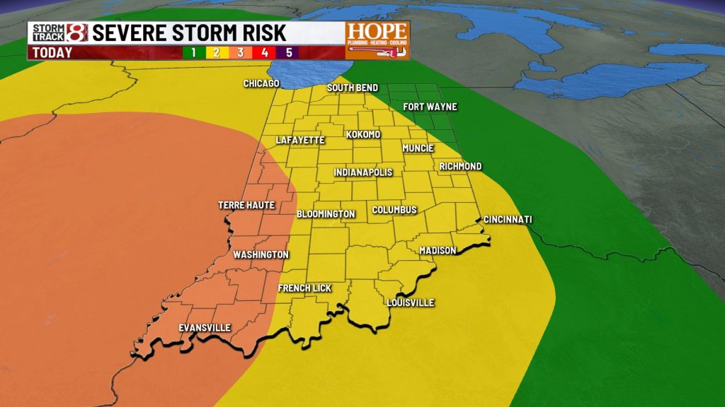
INDIANAPOLIS (WISH) — A very active weather day is expected across Central Indiana, with multiple rounds of thunderstorms through tonight. Some of these storms could be severe, bringing a range of potential hazards.
Severe Weather Risk: What to Expect
Our confidence is high that storms will develop, but the exact timing and evolution remain uncertain due to the potential for multiple rounds of thunderstorms today.
There are two main scenarios we’re monitoring:
1. A large cluster of storms could move in from the west by late morning or early afternoon. Although some weakening is possible (or even likely), strong wind gusts could still occur. If this happens, it would help stabilize the atmosphere somewhat heading into the afternoon.
2. Later-day storm development
If the early storms remain limited, the atmosphere will become more unstable. This would allow new storms to develop rapidly later in the afternoon and evening. These storms could initially be more intense before organizing into a line. That said, the better chance for stronger storms will be across Illinois first. Those storms would then move into Indiana, likely becoming a line later in the evening.
Regardless of which scenario plays out, the environment supports all types of severe weather, with damaging winds as the primary threat across the entire state. Isolated tornadoes will also be possible, especially within the line. Some hail is possible too, although the greatest risk for larger hail appears to remain to our west.
High temperatures will top out in the upper 70s to lower 80s this afternoon.
Tuesday: Mild and calm.
Another system could bring a few isolated showers late Tuesday night, but most of the day should be quiet and pleasant, with highs around 70°.
Cooler air moves in mid-week
After today’s active weather, a noticeable shift is ahead. The second half of the week will be below average for temperatures. With the exception of a few isolated showers Wednesday morning and possible sprinkles on Friday, the overall pattern will be extremely quiet.
Some overnight lows will flirt with 40°, with outlying areas possibly dipping into the 30s. This raises the potential for frost late in the week and into the weekend.
About The Author
You may also like
-
Man fatally shot at Indy gas station, police investigating
-
Fatal crash on Marian University’s campus leaves child dead, 2 injured
-
Shooting in Bloomington along popular Kirkwood Avenue injures 9
-
Trump says suspect was armed with multiple weapons at White House correspondents’ dinner
-
Warm weekend before Monday storms arrive | Apr. 25, 2026