
u0022u0022
INDIANAPOLIS (WISH) — Wet & stormy weather will yield to drier & warmer conditions during the coming work week.
SATURDAY NIGHT:
Partly to mostly cloudy and humid. Areas of locally heavy rain may linger during the evening hours before diminishing. The threat for some additional flooding continues until the rain tapers off. Lows should fall into the 65 to 70 range. Areas of fog are also possible.

SUNDAY:
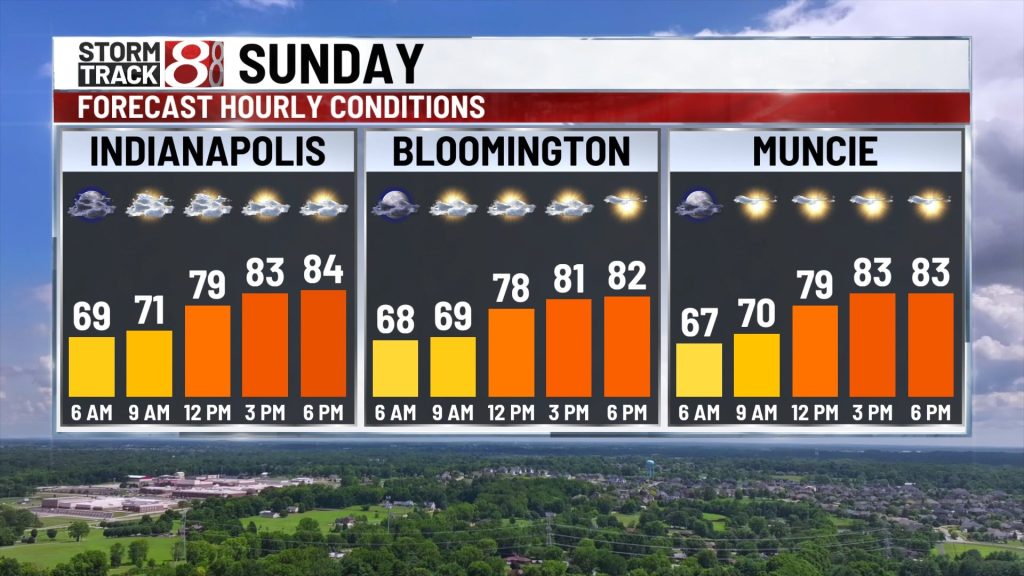
We’ll probably out the with areas of low clouds and perhaps even some fog. Drier air will filter in from the northeast as the day wears on and that should allow brighter skies to develop. Highs in the low to mid 80s are likely by late afternoon. Some spotty rain and clouds could hold on across Southern Indiana.


SUNDAY NIGHT:
Fair skies and cooler. Lows in the mid 60s.
MONDAY:
Partly cloudy. Seasonably warm highs in the mid to upper 80s.

TUESDAY-FRIDAY:
Highs will continue to warm into the upper 80s to lower 90s through the middle of the week as Indiana is influenced by another heat dome. This one won’t be as hot as the one we endured at the start of the month, so extreme heat indices over 105° are NOT currently expected. The chance for spotty to scattered storms will return later in the week and next weekend.

About The Author

You may also like
-
Fever GM defends fans, says criticism has ‘no basis in reality’
-
‘Person shot’ report at Warren Central High School on football night
-
Grand jury indicts 35-year-old man in 2006 Franklin murders case
-
Cat food investigation finds heavy metals, pesticides and plastic chemicals
-
A cold front brings rain, falling temperatures Friday | Oct. 2 , 2026