
u0022u0022
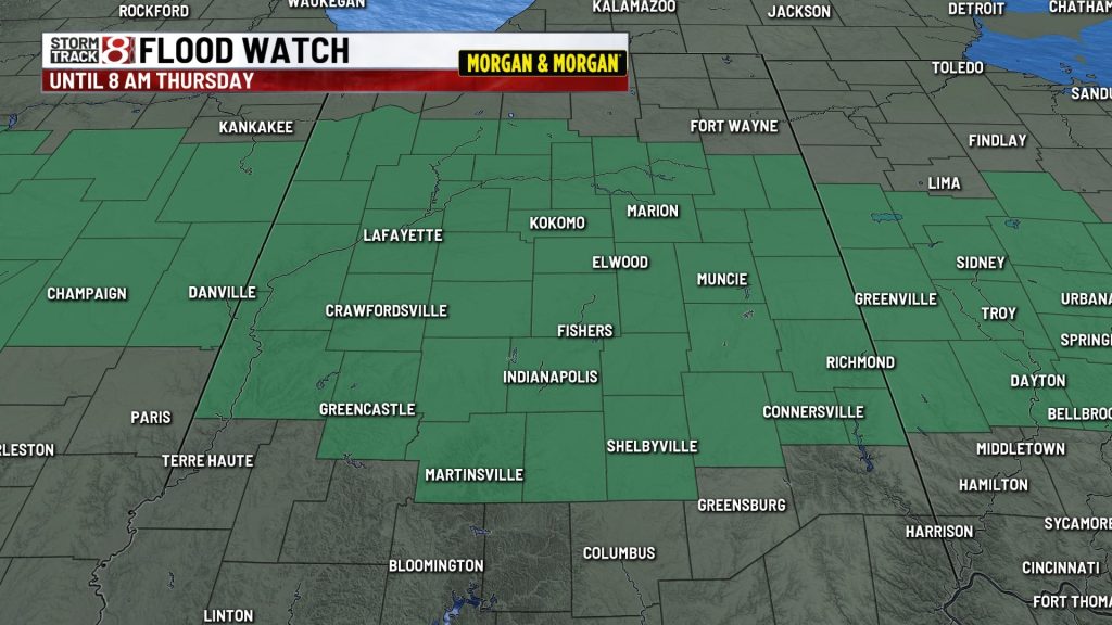
INDIANAPOLIS (WISH) — A flood watch is in effect for Central Indiana through Thursday morning. Another 1-3” could fall in some locations and aggravate the ongoing flooding. A few gusty storms could also occur. Drier weather returns Thursday.

WEDNESDAY NIGHT:
Scattered rain & storms with locally heavy rain possible. Lows in the 60s.

THURSDAY:
Partly cloudy and drier. A isolated afternoon showers or storms could pop south of Indy during the afternoon. Highs will range from the upper 70s to the low 80s.

THURSDAY NIGHT:
Fair skies. Areas of fog are possible. Lows in the 60s and 50s.
FRIDAY:
A mix of sun & clouds with highs in the lower 80s. Temperatures should be primarily in the 70s for high school football in the evening.

WEEKEND:
A passing disturbance may produce a few scattered showers and storms on Saturday. Drier conditions are likely on Sunday. Look for highs in the upper 70s to lower 80s.

About The Author

You may also like
-
Return of rain, some heavy downpours over parts of Indiana Wednesday afternoon | Aug. 19, 2026
-
‘Literally the hub of our town’: Church becomes epicenter of Cambridge City relief effort
-
Kokomo drug bust: 40 arrested in Operation Butterball
-
Carmel warns of 90% chance major sewer line will collapse after flooding
-
Thomas Rhett concert at LIV Golf Indianapolis has been canceled