
Drew 7/27/26 am
MONDAY EVENING/NIGHT:
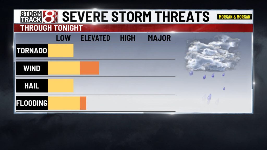
A complex of strong to severe storms remains possible. Damaging wind gusts, flooding, and dangerous lightning are the main concerns. An isolated tornado can’t be ruled out. Not everyone will get a storm. A T-STORM WATCH has been issued until 9 PM EDT. Lows will be in the low 70s by daybreak.
TUESDAY:
Variably cloudy skies are expected. Northerly winds 10-20 mph will be breezy at times, but they will allow less humid air to filter into Central Indiana by late afternoon. Highs are expected to top out in the low to mid 80s.
TUESDAY NIGHT:
Fair skies and comfortably cool conditions develop. Look for lows from the upper 50s to lower 60s.
WEDNESDAY:
Mostly sunny skies set up shop, but elevated smoke from wildfires out west will likely lead to hazy skies. Highs in the low to mid 80s are on track. Conditions look really good and comfy for the first day of Colts training camp. Lows in the 60s and 50s Wednesday night.
THURSDAY:
Partly cloudy and seasonably warm. Highs in the mid to upper 80s. Lows in the 60s Thursday night.
FRIDAY-SUNDAY:
Highs stay in the 80s but we’ll have a chance of showers & storms returning to the region.

About The Author

You may also like
-
1 child dead, another injured after hit-and-run on Indianapolis’ northwest side
-
Fever GM defends fans, says criticism has ‘no basis in reality’
-
‘Person shot’ report at Warren Central High School on football night
-
Grand jury indicts 35-year-old man in 2006 Franklin murders case
-
Cat food investigation finds heavy metals, pesticides and plastic chemicals