
u0022u0022
INDIANAPOLIS (WISH) — More active weather is set to return to Indiana through the middle of the week.
MONDAY NIGHT:
Mostly clear skies continue along with comfortably cool temperatures. Look for lows in the 50s once again. Keep those windows open if you can.

TUESDAY:
Scattered rain & storms return during the afternoon and evening. Some of the storms may be strong to severe with hail and damaging wind gusts the main threats at this time. Highs in the mid to upper 70s are expected. Southwesterly winds may become a bit breezy.


TUESDAY NIGHT:
Variably cloudy. Briefly cooler and drier with lows in the 50s once again.
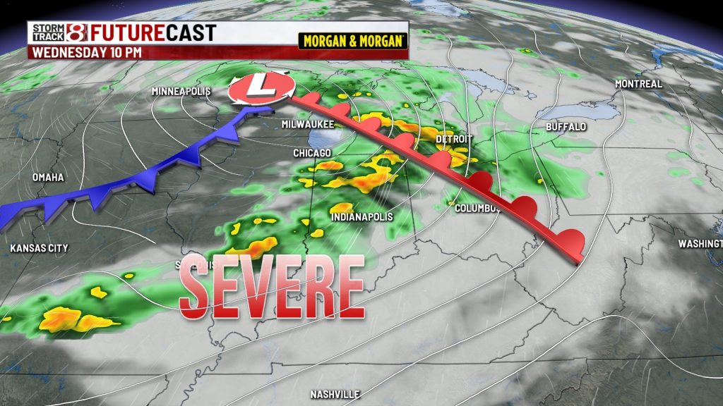
WEDNESDAY:
A strong storm system moving through the Great Lakes region will produce more strong to severe weather. Timing remains in doubt but the atmosphere will have plenty of wind flowing through it during the afternoon and evening and that could lead to more aggressive storms with all hazards possible. This is something you will want to stay weather alert for. Highs should climb back into the upper 70s and lower 80s.


LATE WEEK INTO THE WEEKEND:
The pattern settles down a bit as high pressure returns as we close out the work week and start the weekend. Comfortable highs in the upper 70s to around 80 can be expected along lows in the 50s and 60s. Some rain/storms could creep back by late Sunday and Monday. The summer solstice occurs Sunday at 4:24 AM EDT. We start losing daylight again on Monday.

About The Author
You may also like
-
Scattered strong storms this evening, high-end severe threat on Wednesday
-
Scattered storms today; severe weather likely Wednesday | June 16, 2026
-
Family sues Carmel Catholic school for inaction on son’s harassment, assault
-
Lawsuit accuses Greenwood pool contractor of ‘deceptive’ practices following I-Team investigation
-
IMPD seeks 84-year-old man with dementia missing from south side