
u0022u0022
INDIANAPOLIS (WISH) — We are in WEATHER ALERT mode for scattered strong storms Tuesday evening and more of a high-end severe weather event Wednesday across Indiana.

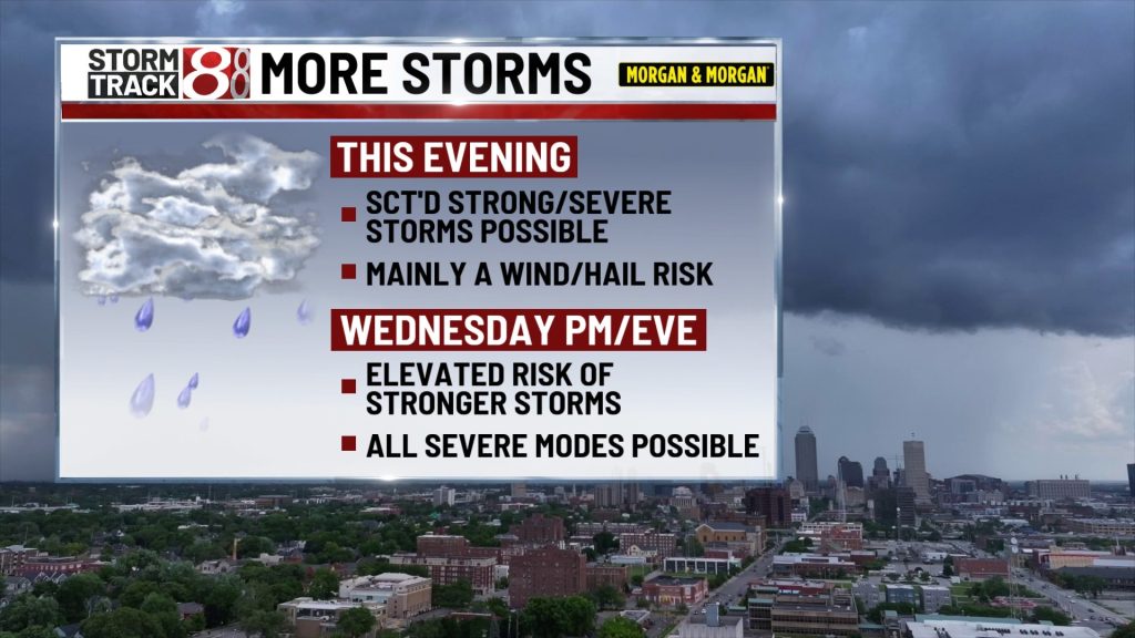
TUESDAY EVENING/NIGHT:
Scattered strong/severe storms remain possible through mid evening with mainly a wind & hail risk but a quick spin-up could occur somewhere north of Indy. Variably cloudy skies are likely overnight with cool lows in the mid 50s.

WEDNESDAY:
A high-end severe weather event appears likely in the region as an unusually strong storm system (by June standards) moves through.

Unstable air and tremendous amounts of wind energy in the atmosphere could produce damaging/destructive winds, tornadoes (some strong), very large hail, and areas of flooding. Non-thunderstorm, gradient winds from the southwest could be 30-40+ mph during the day and into the evening hours.


As for the storm threat… round #1 is possible from late morning through early afternoon, mainly across Northern Indiana. Some severe weather could occur with this first wave but the strongest activity is more likely by late afternoon and evening with round #2.

This second wave will likely be strongest first across Northern Illinois and Northern Indiana before moving to the south during the evening. The severe weather threat will likely continue after midnight south of Indianapolis before pushing out of Indiana by sunrise Thursday.


Temperatures on Wednesday will range from the 70s to mid 80s with the warmest air south of Indianapolis. Low temperatures Wednesday night will stay in the 60s.
THURSDAY:
Variably cloudy skies are expected along with highs in the 70s. There is a small rain/storm chance for Central Indiana but it looks like we’ll remain pretty dry as a whole.
FRIDAY & SATURDAY:
High pressure moves through giving us some pretty nice summer weather with highs in the upper 70s around 80 and lows in the 50s to low 60s. While a few spotty showers could pop up during the daytime hours, I don’t think many of us will have issues either day.
SUNDAY & MONDAY
The summer solstice occurs at 4:24 AM on Sunday. Unfortunately, the odds of rain and storms are increasing across Indiana as we close out the weekend. Sunday is also Father’s Day. It’s too early to tell if any will become strong. The rain & storm chance looks to continue into Monday morning. Tuesday is looking like it will be very nice summer day with sunshine and a high around 80.

About The Author
You may also like
-
Scattered storms today; severe weather likely Wednesday | June 16, 2026
-
Family sues Carmel Catholic school for inaction on son’s harassment, assault
-
Strong to severe storms possible Tuesday, bigger severe event Wednesday
-
Lawsuit accuses Greenwood pool contractor of ‘deceptive’ practices following I-Team investigation
-
IMPD seeks 84-year-old man with dementia missing from south side