
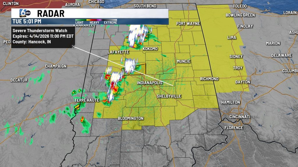
(WISH) — The National Weather Service Storm Prediction Center at 5 p.m. EDT Tuesday issued a severe thunderstorm watch that includes Indianapolis and surrounding counties until 11 p.m. EDT.
Indiana counties in the watch area are Adams, Allen, Bartholomew, Blackford, Boone, Brown, Carroll, Cass, Clay, Clinton, Decatur, Delaware, De Kalb, Fayette, Franklin, Fulton, Grant, Hamilton, Hancock, Hendricks, Henry, Howard, Huntington, Jay, Johnson, Kosciusko, Madison, Marion, Miami, Monroe, Montgomery, Morgan, Noble, Owen, Putnam, Randolph, Rush, Shelby, Tippecanoe, Tipton, Union, Wabash, Wayne, Wells and Whitley.
The watch extends into counties in northwest Ohio.
The weather service on Tuesday afternoon said thunderstorms, some of which could be severe, were possible in the afternoon and evening. All severe hazards are possible including isolated tornadoes.
Storm Track 8 is reporting storms are possible through Saturday in central Indiana, with more severe ones possible on Wednesday, Thursday and Saturday.
About The Author
You may also like
-
WB I-465 closed in Carmel due to cut gas line
-
Warm and muggy conditions fuel thunderstorms across Indiana | Apr. 15, 2026
-
Protesters rally against new board’s impact on Indianapolis education funding
-
‘It was horrible’: Woman shares story of alleged abuse at Lebanon faith-based program for teens
-
Trey Williams sentenced to 6 years in death of former HSE football star Mason Alexander