
Marcus’ 4 a.m. Wednesday forecast
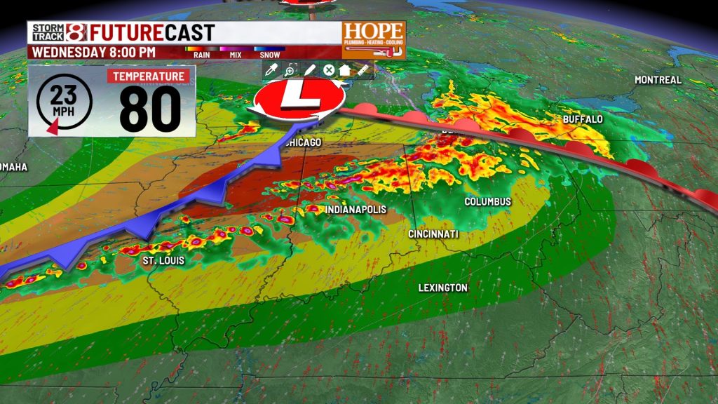
INDIANAPOLIS (WISH) — Central Indiana faces a significant severe weather threat today as an unusually strong storm system for mid-June moves through the region. We’re tracking two rounds of storms, with the most intense weather expected late this afternoon and into tonight.
Today:
The first round of storms is expected this afternoon as scattered showers and thunderstorms push east from Iowa and Illinois. While this wave will be marginally severe, it could still produce damaging winds and heavy downpours, especially in northern Indiana.

Beyond the thunderstorms, gradient winds will be picking up as this strong system moves into the state. Non-thunderstorm wind gusts could reach 40 to 45 mph throughout the afternoon. If you have anything loose outside—lawn furniture, trampolines, decorations—secure it now.

Temperatures will range from the upper 70s in northern areas where clouds and rain will be more frequent, to the mid-80s in the south.

Tonight: The Main Event
The second round is where things get serious. Late this afternoon into the early overnight hours, a more widespread and intense wave of storms will move through Central Indiana.

All types of severe weather are possible:
- Tornadoes: Some could be strong. The tornado threat will be highest in northern Indiana near the warm front, but tornadoes are possible anywhere across Central Indiana.
- Damaging winds: A significant concern with this system. Gusts could exceed 80mph in some of the strongest storms.
- Large hail: Also possible, especially with any supercells that develop.

High moisture levels also increase the risk of excessive rainfall and localized flash flooding, particularly in areas that see repeated storms.
7-Day Forecast:
Once the storm system exits early Thursday morning, a cooling trend begins. Temperatures will remain below normal for much of the week.
- Thursday through Saturday: Mostly dry and cooler with highs in the 70s. High pressure brings us a nice, quiet stretch after today’s active weather.
- Sunday night into Monday: Another low-pressure system could bring more rain to the area, though timing remains uncertain. Temperatures will continue running below normal.
About The Author
You may also like
-
IMPD responds to downtown stabbing at Indiana Convention Center
-
Severe storm watch issued for much of Indiana, including Indianapolis area
-
Scattered strong storms this evening, high-end severe threat on Wednesday
-
Scattered storms today; severe weather likely Wednesday | June 16, 2026
-
Family sues Carmel Catholic school for inaction on son’s harassment, assault