
u0022u0022
INDIANAPOLIS (WISH) — Several more unsettled days with wet & stormy conditions are lurking at the end of the week and start of the weekend.

TUESDAY NIGHT:
A mix of stars and clouds. Lows in the mid to upper 60s.

WEDNESDAY:
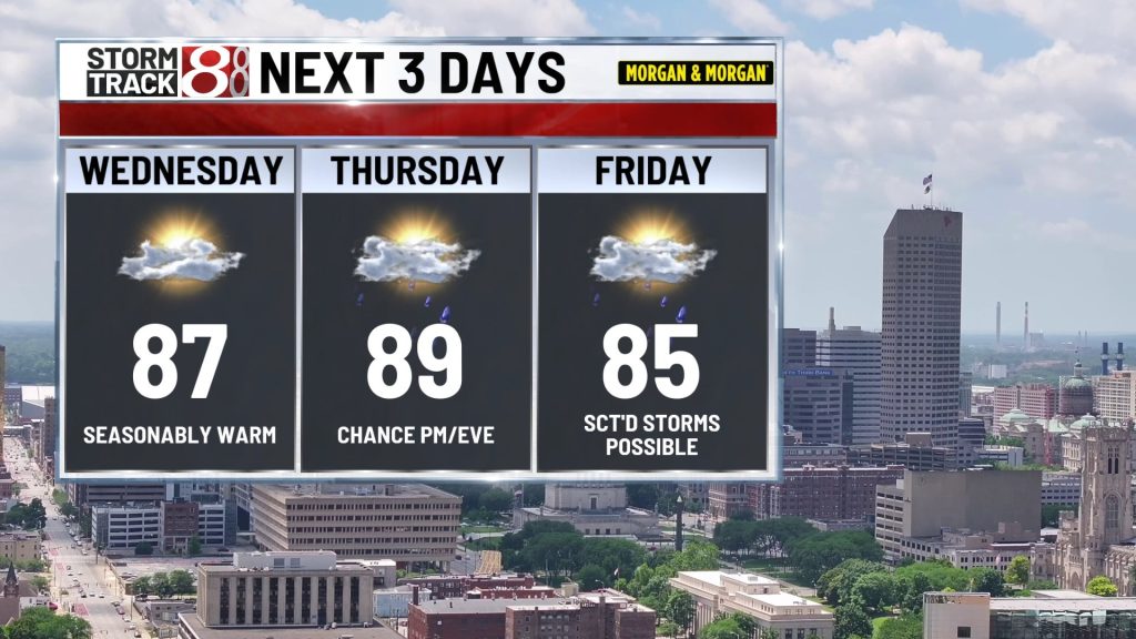
Variably cloudy and warm with highs in the mid to upper 80s. A spotty afternoon storm or two is possible, especially south of Bloomington/Columbus towards the Ohio River. Most locations will remain in dry. Lows near 70 Wednesday night.

THURSDAY:
Warm & humid with highs in the mid to upper 80s. Odds of scattered rain & storms will increase during the afternoon and evening hours, but many spots may not have a lot of rain of most of the day.
THURSDAY NIGHT:
Scattered rain & storms are likely. Some storms could be strong with gusty winds and heavy rain. A LEVEL 1 severe risk has been added for most of Indiana for the chance of a few strong storms, especially Thursday night. Areas of flooding could develop if storms end up going over the same places over and over. Lows will be near 70.


FRIDAY:
The chance of scattered rain & storms will continue. With a humid environment in place some of the storms could produce more heavy rain. Highs should generally be in the mid to low 80s. Lows in the upper 60s are likely Friday night.

WEEKEND:
Additional showers & storms are likely on Saturday with lower odds returning Sunday. Highs should be in the 80s with lows in the 60s.
RAIN OUTLOOK:
Recent data suggest that some locations could pick up another 1-3″ through Sunday. There is also a chance that a few strong/gusty storms could occur at some point.
NEXT WEEK:
There are some signs that another heat dome could nudge back into the Great Lakes for a few days. If this happens, temperatures will surge higher for a few days, but it’s not set in stone just yet. On the flip side, if the heat doesn’t build in, our region could get into a pattern that would allow storm complexes to roll in from the northwest.

About The Author

You may also like
-
Franklin grandmother fights for grandparent visitation rights in Indiana
-
Carmel man faces charges for child sex crimes and trafficking
-
19-month-old pulled from retention pond in Lawrence dies, police investigating
-
Shooting on Indy’s near east side leaves one dead, one critically injured
-
Man involved in far east side crash dies after being hit by second vehicle, police say