
Marcus’ 4 a.m. Thursday forecast
INDIANAPOLIS (WISH) — A cold front will bring strong to severe thunderstorms to Central Indiana tonight, with damaging wind gusts and localized flooding as the primary hazards, before the system clears out and temperatures cool down for the weekend.
This Morning: Storms Exiting From the Northwest
An overnight storm cluster is moving through Indiana. Thunderstorms with gusty winds are still possible as far southeast as Indianapolis through the morning hours. Heavy downpours are also possible. Conditions should improve as the system exits and skies begin to clear by mid morning.
Today: Dangerous Heat
Once the morning storms clear out, a hot and brutally humid day takes over. Temperatures climb to near 90° with dew points in the low–to–mid 70s, pushing the heat index to 100 to 105° during peak afternoon hours.


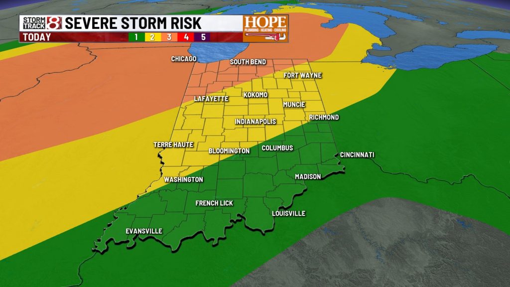
Tonight: Strong to Severe Storms Possible
Another wave ejecting from the west brings another line of storms to the state. Guidance shows more atmospheric energy available with this system compared to last night, raising the potential for strong to severe thunderstorms — particularly across northwestern portions of Central Indiana, where conditions are more favorable for severe weather.

Damaging wind gusts are the primary hazard. Localized flooding is a secondary threat given how saturated the ground remains across much of the region after the past two weeks of nearly relentless rainfall.
A cold front pushes through with this system late tonight, and that frontal passage is the key to unlocking the better weather ahead.
Friday Through the Weekend: A Much-Needed Reset
Once the front clears late tonight, the pattern shifts. A nice cool down with dry air moving in — highs near 80°, lows near 60°.


Sunday brings the next rain chance as a weak disturbance moves through. Isolated to scattered showers or storm is possible — nothing like the organized, widespread events of this week.
Further disturbances may bring additional slight rain chances Tuesday & Wednesday of next week. The overall theme for the forecast is much more comfortable for most of next week.

About The Author
You may also like
-
Honda recalls 800,000 vehicles for rear suspension defect
-
Indiana households struggle as essential costs outpace inflation for 15th year
-
Boy dies after being hit by vehicle in Westfield
-
Thunderstorm watches issued for much of the northern half of Indiana
-
Person dies in motorcycle, SUV crash at Harding Street intersection