
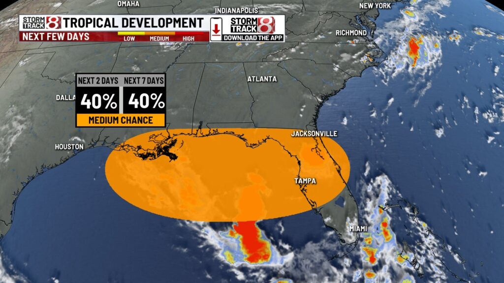
INDIANAPOLIS (WISH) — The National Hurricane Center has designated an area for potential tropical development near Florida. They have assigned a disturbance a 40% chance of formation in the next 48 hours. ‘Dexter’ is the next named storm.

Potential Track
Currently, Invest 93L, the area where the National Hurricane Center is keeping an eye on, is impacting Florida with heavy rain at times. The storm will reemerge over the Gulf on Wednesday, where organization could take place.
Most models have this low, whether it develops or not, moving over NW Florida or hugging the coast to Louisiana, Thursday or Friday.


Down the line, the moisture from what’s left over from this system could enter the Ohio River Valley late weekend into early next week.
Last year, we had moisture from Hurricane Helene and Beryl make it to our area. Helene’s remnants knocked out power for many with peak wind gusts of 50-70 mph in central Indiana.
You can always find the latest update on the tropics by visiting our weather stories page here.
About The Author
You may also like
-
Indy Moms: Avoiding stress from back-to-school season
-
Indiana Fever bring back popular ‘Stranger Things’ jersey
-
Kyle Gibson, Greenfield native, announces end of MLB career
-
Colts share details on training camp autograph sessions
-
New federal rules require tougher side-impact testing for child car seats