
Tue evening forecast – Jul 15, 2025
INDIANAPOLIS (WISH) — Same old song and dance with very warm temperatures, terrible humidity, and showers/storm development will continue through midweek.
Tuesday night: Scattered showers and storms will persist into the overnight hours due to a nearby disturbance and high humidity values. Lows will only drop into the low 70s.


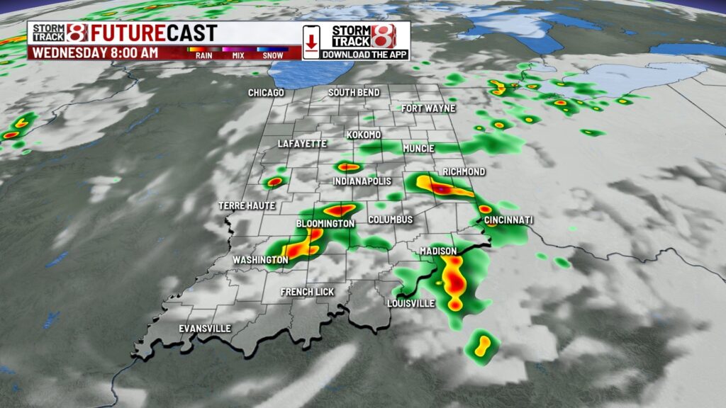
Wednesday: Scattered showers and storms with some heavy rainfall are expected through sunrise Wednesday, which could impact the morning commute. Additional pop-ups are possible into the afternoon and evening hours as we watch for the potential of a broken storm line moving into the state. This looks to transpire closer to the evening and nighttime hours.


The aforementioned broken cluster could hold together long enough to produce isolated strong to severe wind gusts. Hence, why we have a level 1/5 strong to severe storm risk.

Highs in the upper 80s and extremely muggy. Feels like temperatures will be in the mid to upper 90s.

Thursday: We’ll undergo another round of very warm and swampy air with scattered shower/storm development Thursday. A front will creep through the state and aid in the development of activity. We cannot rule out isolated stronger storms with gusty winds the main concern.


Highs in the upper 80s.

7-Day Forecast: Daily rain/storm chances, warm temperatures, and a cranked muggy meter will be our story into this weekend. Next week is showing signals of hotter temperatures and higher heat indices. We will keep an eye on how this continues to evolve on models, but for now, we’re holding off on a concentrated discussion about next week’s forecast until at least the end of the workweek.

About The Author
You may also like
-
Homeless encampment expands in Indianapolis neighborhood
-
Former Muncie woman sentenced to 30 months for $930,000 in FAFSA fraud
-
32-year-old Elwood man charged with child exploitation
-
Prosecutor criticizes proposed state control of Indianapolis Mile Square
-
Colts hungry to prove themselves as Training Camp begins