
August 18, 2025 morning forecast with Tara Hastings
INDIANAPOLIS (WISH) – Showers and thunderstorms possible on and off throughout the day today thanks to a cold front moving across the state. Once this cold front moves through we will see less humid air through the rest of the week and a secondary front will bring us even cooler conditions over the weekend.
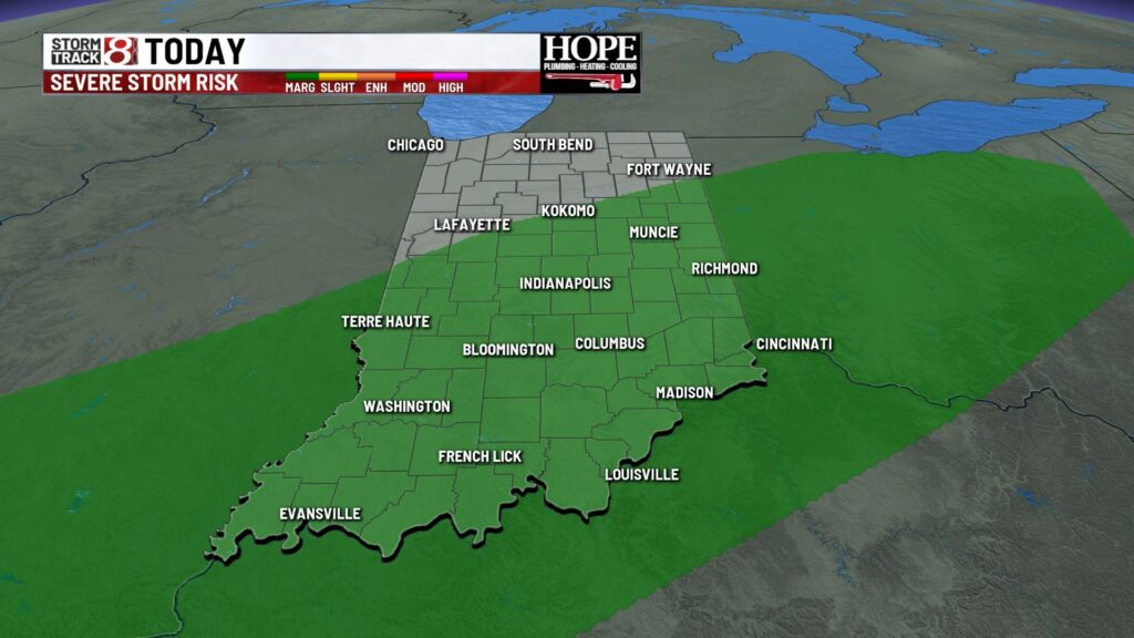
TODAY: Showers and thunderstorms possible early this morning. Some of those could contain some gusty winds and lots of lightning. We’ll get a break and then another chance for some more spotty showers and thunderstorms into the afternoon. We have a marginal risk which is a level 1 out of a level 5. Some of those thunderstorms could be on the stronger side. Gusty winds, heavy rainfall and lots of lightning are possible with some of these thunderstorms.


We have one more hot and humid day before less humid air works into the state.
Temperatures will climb into the upper ’80s near 90. Feels like temperatures will be into the mid-90s.

TONIGHT: Showers come to an end later tonight we’ll hang on to the cloud cover. Low temperatures will fall near 70.

TOMORROW: Partly cloudy to mostly cloudy conditions expected on your Wednesday. We will see highs only around the lower ’80s. Humidity values do drop a little bit so it feels less intense out there.


7 DAY EXTENDED FORECAST: Dry conditions continue for the end of the week and into the weekend as well. Look for partly cloudy skies on Thursday seasonable temperatures with readings into the mid-80s. On Friday for the first high school football game of the season looks like we will be dry with temperatures into the mid-80s. For the weekend another cold front begins to move in and that will usher in even cooler temperatures. By the end of the weekend high temperatures only in the upper 70s and early Monday morning we could see temperatures into the upper ’50s.


