
July 20 | Evening Forecast with Meteorologist Drew Narsutis
TONIGHT

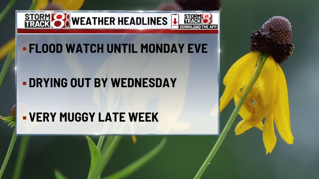
Scattered showers and thunderstorms continue through the evening, and a few stronger cells could still pack damaging wind gusts or brief hail. Flash flooding remains a concern with rounds of heavy rain possible, especially across central and southern Indiana. A Flash Flood Watch remains in effect through 8 PM Monday. Expect a muggy night with mostly cloudy skies and lows in the low to mid 70s.
TOMORROW

Another round of storms is expected, especially during the afternoon and evening. A few storms may produce heavy rainfall or gusty winds, but severe weather looks isolated. Cloud cover and scattered rain will hold temperatures to the low 80s in many spots—though areas that stay drier could sneak close to 90. High humidity continues, keeping conditions uncomfortable even between storms.
TOMORROW NIGHT
Rain and storms gradually taper off during the late evening, but pockets of light rain may linger into the early morning. Flood-prone areas should be cautious, especially if they’ve already picked up heavy rain over the weekend. Lows settle near 70 under mostly cloudy skies.
TUESDAY
A refreshing break arrives Tuesday. Most of central Indiana stays dry under a mix of sun and clouds. With just a small chance for a pop-up shower southwest of Indianapolis, the day will be warm but not quite as muggy. Highs climb into the upper 80s with a touch more comfort in the air.
TUESDAY NIGHT
Quiet weather continues Tuesday night with mostly clear skies and lows around 70. Winds stay light out of the southeast.
WEDNESDAY
Heat and humidity return quickly. Mostly sunny skies and south winds will send highs into the low 90s, with heat index values nearing 100. A pop-up storm can’t be ruled out late, but most areas remain dry.
WEDNESDAY NIGHT
A warm and muggy night is ahead. Mostly clear skies with lows in the mid 70s. Little relief from the heat overnight.
THURSDAY
The heat peaks on Thursday. Highs soar to the mid 90s, and with oppressive humidity, heat index values will likely top 100 degrees. A few storms may fire during the evening, but coverage should stay isolated.
THURSDAY NIGHT
Partly cloudy, warm, and sticky. A slight chance of a shower lingers through early evening, with overnight lows again only dipping to the mid 70s.
7 DAY FORECAST

We’ll start the week unsettled, with more rounds of storms likely on Monday and a continued risk for localized flooding. By Tuesday, we catch a brief break—sunshine returns, and highs warm into the upper 80s with more tolerable humidity. But by midweek, heat and moisture surge back in. Wednesday and Thursday will be hot and very humid, with heat indices pushing or exceeding 100 degrees. Rain chances stay minimal until late Thursday. The heat holds into Friday, with a better chance for storms arriving late. Next weekend looks stormier, but slightly cooler, with highs dipping back into the 80s by Sunday.