
INDIANAPOLIS (WISH) — Strong winds, torrential downpours are in play over the next few days.
Today:
Scattered showers and possibly a stray thunderstorm will move through the region this morning along a surface boundary that will shift south throughout the day. This should keep most rain chances away from Central Indiana by late morning through the rest of the afternoon.

High temperatures will reach the mid-80s, with very high humidity making for another uncomfortable afternoon.

Tonight:
Early to mid-evening should be relatively quiet with mostly cloudy skies. An upper-level wave moving through during the overnight hours could produce scattered showers and thunderstorms after midnight into early Saturday morning.
Lows will dip into the lower 70s.
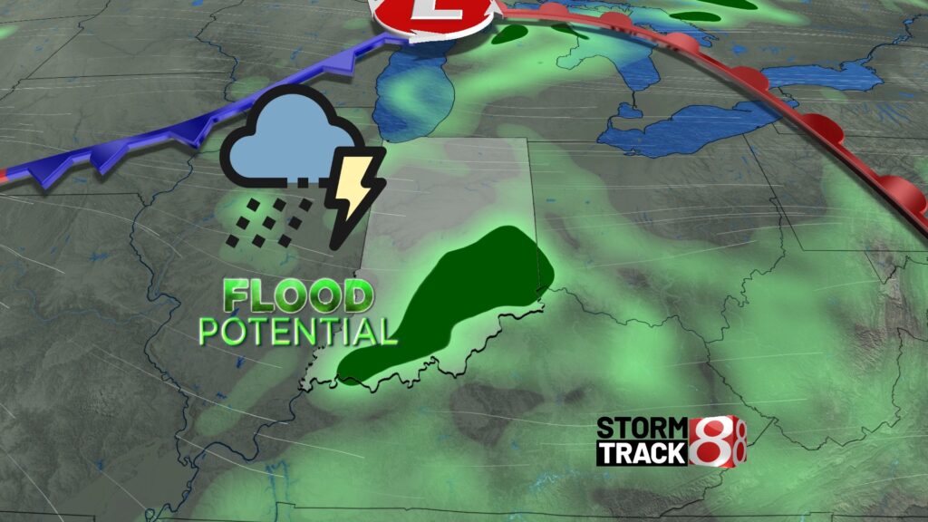
Heavy rain, strong storms this weekend:
We will be tracking several weather systems moving through the state this weekend. Scattered showers will linger early Saturday morning, with the main event likely occurring in the afternoon, currently expected between 2 PM and 8 PM. An organized mesoscale convective system (MCS) is forecast to move into the state from the west, bringing a threat of damaging winds and some hail. While a few tornadoes cannot be ruled out, the best conditions for tornadoes will be in the far northern portions of the state.

Localized flooding is also a concern, as heavy rainfall is likely with any storms—severe or not—moving through Saturday afternoon. Rainfall rates of one to two inches per hour or more will be common.
Clusters of showers and thunderstorms will continue through the evening and overnight but will be less organized, so many areas may remain dry.
Sunday will bring persistent rain and thunderstorm threats, with high instability and abundant moisture in the air. While the severe weather threat is slightly lower, gusty storms are still possible. The primary concern will be very heavy rain and localized flooding, especially in areas already saturated from Saturday’s rainfall.
It’s difficult to pinpoint exactly when rain will occur on Sunday. It’s unlikely to rain all day, but if you have outdoor plans, monitor the radar, as showers and storms could develop at any time.
High temperatures will reach the mid-80s on both Saturday and Sunday, which is seasonal.
Next week:
The active weather pattern will continue into the workweek, with scattered rain chances on both Monday and Tuesday. Heavy rain will remain a concern early in the week.

Rain and thunderstorm chances will decrease as a heat dome builds over the eastern United States. This will bring a dangerous wave of high heat, with highs in the low to mid-90s and heat indices ranging between 105 and 110°F starting Wednesday of next week.
No relief from the high heat and humidity is expected, with above-average temperatures forecast through the end of July.