
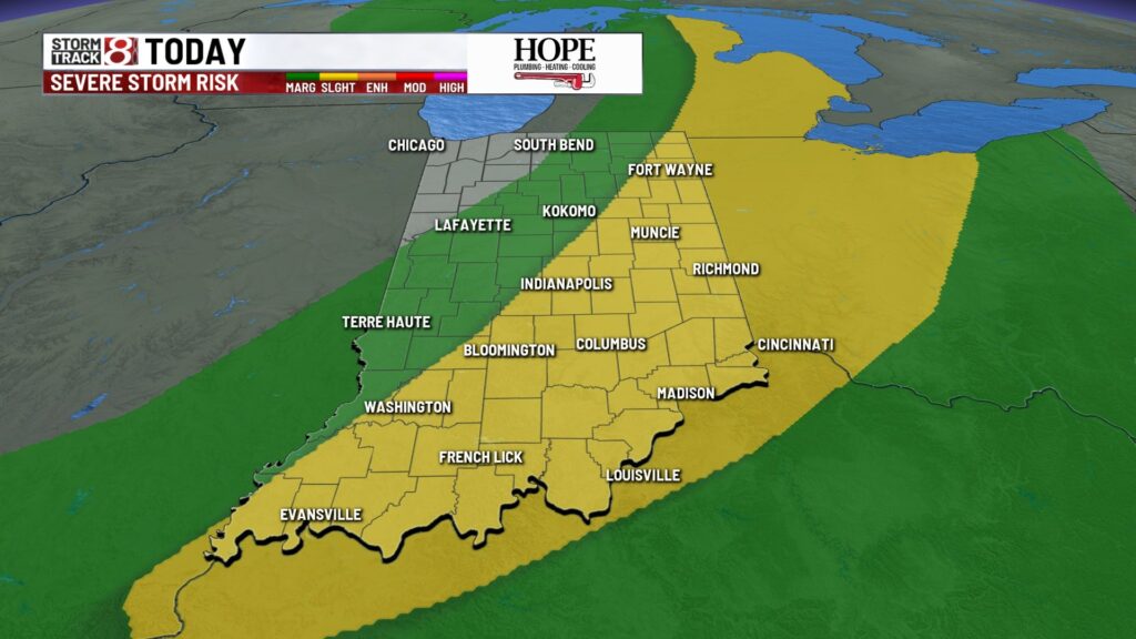
INDIANAPOLIS (WISH) — Another hot one is expected for today. That will fuel our slight risk of severe weather later today.

TODAY: Partly cloudy. A slight (2/5) risk is in place along and east of I-69. Scattered showers and storms will develop and cross central Indiana between 2 pm and 8 pm. Damaging wind is the primary concern. High temperatures in the low 90s with very humid air. Peak heat index values will get into the mid and upper 90s.


TONIGHT: Rain exits. Skies return to partly cloudy as a cold front slips to the south. Low temperatures in the low 70s.

TOMORROW: Mostly sunny skies turn partly cloudy. Isolated pop-up storms in the PM hours. Severe weather is not expected. High temperatures in the mid-80s.


7-DAY FORECAST: Temperatures stay warm this week. Most days will be in the upper 80s. Another organized system will bring scattered rain chances into parts of Wednesday and Thursday.

You can always track the latest storm development by visiting our interactive radar here.
About The Author
You may also like
-
Indianapolis teen hosts event to help reduce youth violence
-
Colts WR Alec Pierce draws rave reviews from teammates, coaches
-
Residents of Indianapolis homeless camp scramble for new housing
-
Colts’ Michael Pittman Jr. puts Tyler Warren through off-field ‘test’
-
1 dies in 2-car collision on State Road 234 in northeast Hancock County