
(WISH) — A severe thunderstorm watch is in effect until midnight Thursday for Indianapolis and other central Indiana counties.
The Severe Thunderstorm Prediction Center at 7:45 p.m. Thursday issued the watch for these Indiana counties: Allen, Blackford, Boone, Carroll, Cass, Clay, Clinton, Delaware, De Kalb, Fulton, Grant, Hamilton, Hancock, Hendricks, Howard, Huntington, Johnson, Kosciusko, Lagrange, Madison, Marion, Miami, Montgomery, Morgan, Noble, Owen, Putnam, Steuben, Tippecanoe, Tipton, Wabash, Wells and Whitley.
Other cities in the watch area are Angola, Carmel, Crawfordsville, Fishers, Fort Wayne, Kokomo, Logansport, Noblesville, Marion, Muncie, Warsaw and Westfield.
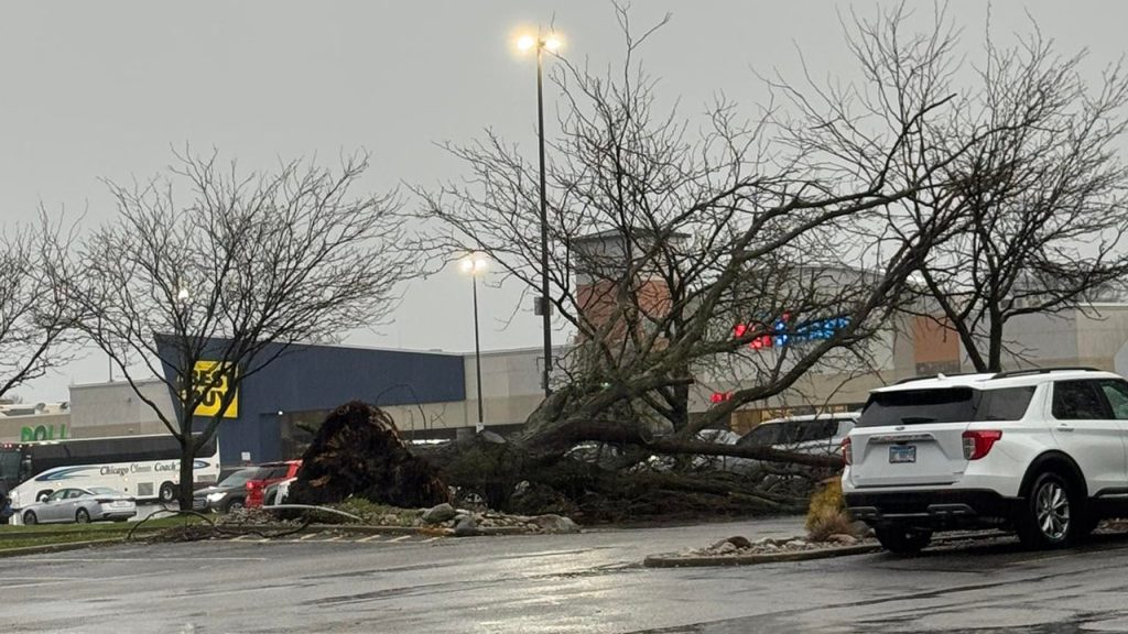
Storm warnings that had been issued earlier for the watch area warned over 60 mph gusts, which can cause damage to roofs, siding and trees. Tornadoes are possible.
As of 9 p.m., an automated system from the National Weather Service at Indianapolis said a storm spotter reported a large tree being uprooted on the southwest side of Terre Haute about 7:14 p.m. due to thunderstorm winds.
Also, about 14% of electricity customers in Parke County, north of Terre Haute, were without power at 9 p.m. Thursday. About 40 minutes earlier, about 24% of Parke County electricity customers were without power.
About The Author
You may also like
-
Man sentenced to 98 years for 2-day crime spree in Indianapolis
-
The Zone Extra | April 2, 2026
-
IMPD nabs 18 in near north side drug investigation
-
Wind advisory issued for central Indiana with gusts up to 50 MPH | Apr. 2, 2026
-
Higher ed commission approves consolidation, elimination of hundreds of degrees