
Tue evening forecast – Jul 29, 2025
INDIANAPOLIS (WISH) — Today ended up being our hottest day of the year in Indianapolis with a high of 95 degrees. It was our first 95+ high since Aug. 30th last year.

We will have to endure one more hot day before increasing rain and storm chances lead way to fantastic air entering August.
Tuesday night: Mostly clear and warm with lows in the mid 70s.


Wednesday: One last hot day expected before our big and highly anticipated pattern change takes place. Expect highs to push into the low to mid 90s with peak heat indices up to 100+ at times.


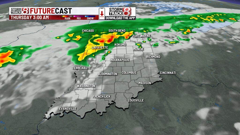
By the latter half of Wednesday, especially into early Thursday morning, we’ll see an increase in rain/storm coverage. It is possible for there to be isolated strong to severe storms with damaging wind the primary concern. Local flooding concerns will also be in place.


Thursday: Scattered showers and storms will persist through Thursday as a slow moving front continues to progress through the state. This is where we finally get to embrace some cooler air with highs in the upper 70s to low 80s. However, the muggy meter will still be in the uncomfortable range.


7-Day Forecast: Friday to kick off August is when we see pleasant weather come full circle with upper 70s highs and a tamed muggy meter. This beautiful weather will carry on through the first weekend of August!


About The Author
You may also like
-
Feeling the pinch? Here’s how to tackle credit card debt
-
Operation Indy Animals receives $50K grant to expand spay, neuter services across city
-
‘It’s just tragic’: Woman hit, killed by vehicle near Crown Hill Cemetery
-
Daybreak Drive-IN: Massive earthquake unleashes waves of fear
-
Indy councilor denies groping woman on second date