
INDIANAPOLIS (WISH) — We are closely monitoring the potential for strong to severe storms into Tuesday evening and night.
***Tornado Watch*** remains in effect for western Indiana until 9 PM EDT and southern Indiana until 11 PM EDT.

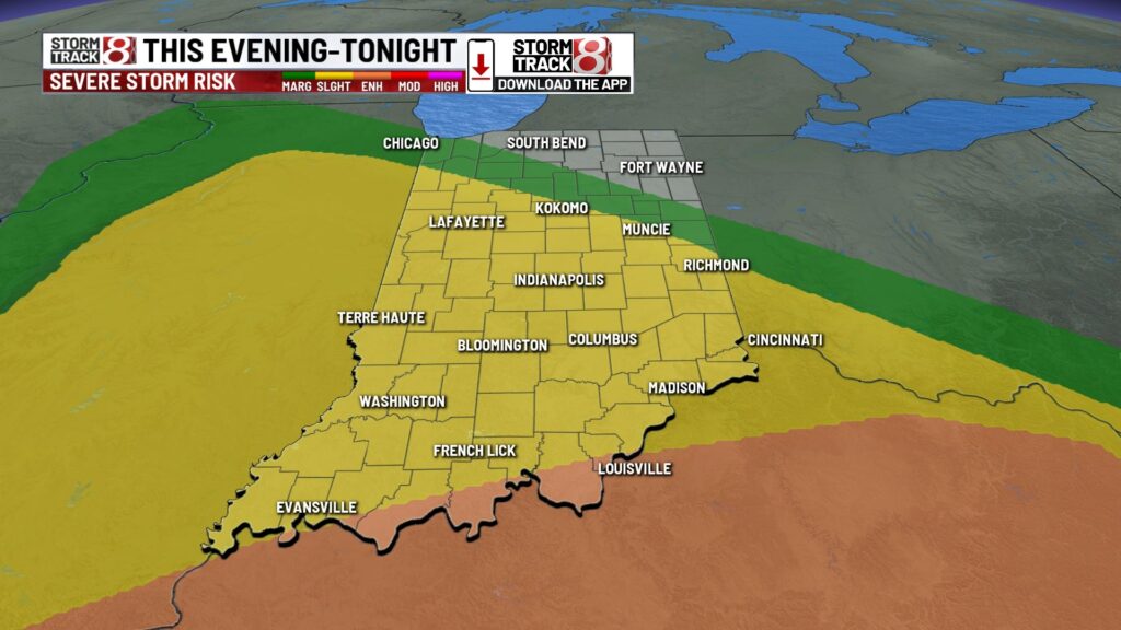
Tuesday night: We’ll continue to watch how far north a warm front gets into this evening and tonight. Additional showers and storms will develop through this timeframe, and a few of these storms may be on the stronger side along/south of the warm front.


A Slight Risk (level 2/5) is in place across a good chunk of central Indiana. Wind is the main threat, but isolated tornadoes and hail are also possible. Timeframe for potential severe weather will be until midnight tonight.

Lows to fall into the upper 50s.

Wednesday: A few showers remain possible through Wednesday under mostly cloudy skies. Highs are going to only make it into the mid 60s. It will also be windy with gusts out of the west up to 30-35 MPH at times.


Thursday: Can’t rule out spotty showers into and through the daytime hours Thursday. We’re talking even cooler highs with numbers only in the upper 50s to low 60s. Winds will also stay breezy out of the northwest with gusts of 25-30 MPH.

7-Day Forecast: The below normal temperature trend persists into Indy 500 race weekend. Carb Day on Friday will feature highs in the mid 60s with partly cloudy skies. By Indy 500 race day on Sunday, we’ll track a rain chance that currently looks to be mainly south for now. Highs will rise into the mid to upper 60s.

About The Author
You may also like
-
Serving sweet little lies at the Indiana State Fair’s Liar’s Contest
-
Indiana Grown: Kayak Coffee’s small batch roasted delights
-
Scattered rain chances this weekend, staying muggy | July 26, 2025
-
Fort Wayne police charge woman in deadly 2021 hit-and-run
-
Team 23XI Racing’s event kicks off Brickyard weekend