
Marcus’ 4 a.m. Tuesday forecast
INDIANAPOLIS (WISH) — Slight relief from the intense heat is expected midweek before another surge of hot temperatures arrives this weekend.
Today:
Mainly clear conditions will start Tuesday morning, with no issues expected for the morning commute. Conditions will remain quiet, very warm, and humid through the early afternoon.
High temperatures will reach the upper 80s to lower 90s, with heat index values in the mid to upper 90s this afternoon.

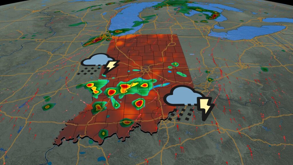
Storm chances return:
An upper-level trough will move through the region this afternoon, sparking scattered showers and thunderstorms late this afternoon into the evening. While no severe weather threats are expected, there is potential for locally heavy rainfall with any storm that develops.


Storm chances will likely continue into the late evening and gradually diminish overnight.
Wednesday:
A frontal boundary will move through the state on Wednesday, likely triggering scattered showers and thunderstorms with the heating of the afternoon. As on Tuesday, no severe weather is expected, but some locally heavy downpours are possible.
The best chances for precipitation on Wednesday will likely be along and south of Interstate 70 during the afternoon.

Meanwhile, high temperatures should cool a few degrees due to cloud cover and rain chances, reaching the mid to upper 80s across the state.
Thursday should be a dry day with seasonable temperatures and slightly drier air.
Hot weekend ahead:
Another strong ridge of high pressure will build back for the end of the week and into the weekend, bringing a hot dome of air starting Friday. This could bring the hottest air of the season this weekend, with highs in the upper 80s on Friday and potentially the mid-90s over the weekend.

The hot temperatures could persist into next week, depending on the track of Tropical Storm Aaron, currently in the eastern Atlantic. Aaron could block the weather pattern in the lower 48 states, keeping us in a very hot and humid weather pattern for an extended period.
About The Author
You may also like
-
Taylor Swift announces 12th studio album, ‘The Life of a Showgirl’
-
Mayor Hogsett introduces $1.7 billion budget proposal for 2026
-
18-year-old faces attempted murder charges in Jennings County stabbings
-
Colts offensive coordinator weighs in on QB competition
-
Shooter kills 3 in a Target parking lot in Texas, before being captured, police say