
July 9 | Evening Forecast with Chief Meteorologist Keith Gibson
INDIANAPOLIS (WISH) — Hot and more muggy air with increasing rain and storm chances are ahead into this weekend.
Thursday night: We’re eyeing a warm and mostly to partly clear night. There will be a decaying cluster of showers and storms that slides into mainly northern portions of the state through the pre-dawn hours Friday morning. A few showers may skirt down closer to I-70. Lows in the upper 60s to low 70s.

Friday: The aforementioned decaying cluster will persist through sunrise to our north. We’ll launch into a hot and more muggy day overall with the potential for stray pop-up showers and storms. Highs look to peak in the low 90s for some locations. Heat index values will be in the mid to upper 90s.


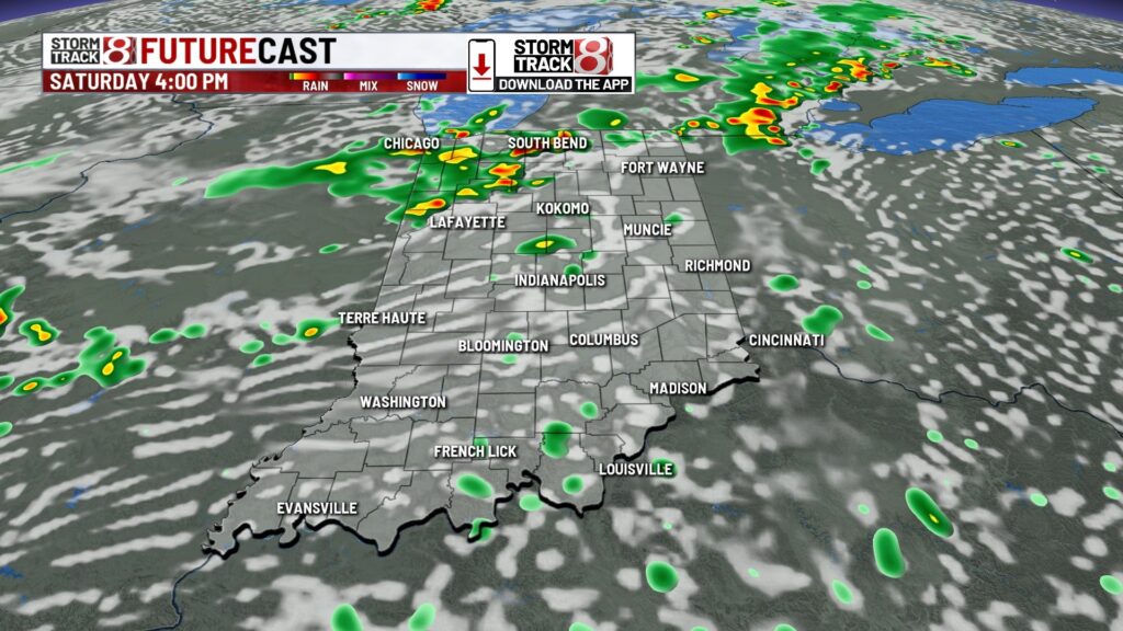
Saturday: Rain and storm chances begin to increase into this weekend. A more organized system will move into the Great Lakes region with a cold front just off to our west. We could see scattered showers and storms form, especially in the afternoon and evening hours.


Isolated strong to severe storms are also possible Saturday afternoon and evening. The threat is higher in far northeast Indiana as of now. Damaging winds are the primary concern. Local flooding with these heavier downpours will also be of concern.

Highs in the low 90s.


7-Day Forecast: We could see rain and storm chances persist towards late Sunday depending on how this next system evolves. If we do see this materialize, we’re not ruling out isolated stronger storms either on Sunday. A brief break from activity looks to emerge early next week before more rain chances appear by next Wednesday. We will remain warm and humid into the first half of next week.

About The Author
You may also like
-
Colts, LT Bernhard Raimann agree to contract extension
-
Shooter who killed 4 at Manhattan office building was targeting NFL headquarters
-
Excessive heat continues Tuesday, relief returns to central Indiana late week. | July 29, 2025
-
Former Warren Central star JuJu Brents healthy, ready for Year 3 with Colts
-
Indianapolis program aims to house homeless people, but not ones in Fountain Square