
July 13 | Evening Forecast with Meteorologist Drew Narsutis
TONIGHT

Scattered thunderstorms will gradually taper off this evening, especially south of I-70, as the upper-level wave pulls east. A few stronger storms could linger early, but severe weather risk is low. Still, downpours may lead to minor localized flooding in spots. Expect partly to mostly cloudy skies overnight with patchy fog possible near sunrise. Lows fall to the upper 60s with calm or light west northwest winds.
TOMORROW

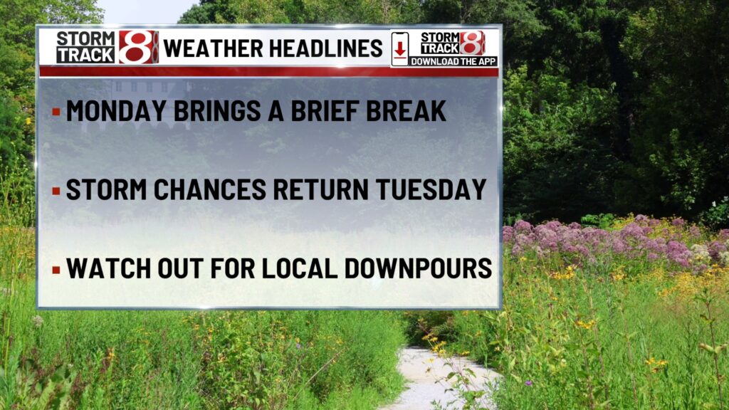
Monday offers a break from the heavier storm activity, though a few isolated showers or storms could pop up early in the day and again in the afternoon. Skies will be partly sunny with modest humidity, making it feel a bit more comfortable than the weekend. Highs top out in the mid 80s with heat index values remaining in the upper 80s to near 90. Winds will be light and variable.
TOMORROW NIGHT
A quiet and mild night ahead with partly cloudy skies and lows settling near 70. Winds turn light from the east as humidity begins a slow climb again heading into Tuesday.
TUESDAY
A return to classic mid-July heat and humidity. Highs rise to the upper 80s, and heat index values may push the mid 90s. A mix of sun and clouds is expected, and scattered showers and storms become more likely during the afternoon. These may be hit or miss but could drop brief heavy rain where they develop. Winds shift from calm to south southeast around 5 to 10 mph.
WEDNESDAY
Warmer and more humid. Partly sunny skies with more widespread afternoon and evening storms. Highs reach the upper 80s and heat indices again range from the mid 90s to around 100 in spots. Expect some heavier downpours and gusty winds in stronger cells. Chance of precipitation is 60 percent.
THURSDAY
Another stormy afternoon likely. Storms may arrive a bit earlier than previous days with the potential for stronger activity again during peak heating. Partly sunny skies early, then increasing clouds. High near 88 with heat indices again near or just above 95. Storms could be locally heavy with rain and wind.
7 DAY FORECAST

After a quiet Monday, expect daily storm chances through Thursday—mainly in the afternoon and evening, with a humid and very warm pattern continuing. Highs stay in the upper 80s with lows around 70. Friday and Saturday may bring slightly cooler and less humid conditions if a cold front can finally push through.
About The Author
You may also like
-
Caitlin Clark trading card breaks record, selling for $660,000
-
Jeffrey Epstein’s former girlfriend completes interviews with Justice Department
-
Heat lingers as weekend storms brew | July 25, 2025
-
Larson eyes history in return to IMS for Brickyard 400
-
Felon with history of domestic violence kills wife in Indianapolis