
Marcus’ 4 a.m. Wednesday forecast
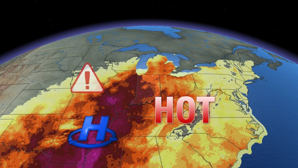
INDIANAPOLIS (WISH) — Heat advisories will go into effect for parts of the state today.
Today;
An upper-level ridge is beginning to build across the eastern portions of the country. While we’re starting the morning with very comfortable, mild temperatures and relatively low humidity, that will gradually change as we head into the afternoon hours.
High temperatures will reach the upper 80s to around 90°F.

Most importantly, our dewpoint temperatures will rise significantly in the afternoon, ranging into the low to mid-70s, making conditions much more uncomfortable.
The highest dewpoint numbers will be in the western parts of the state, where a heat advisory will be in effect. The heat index could be near or above 105°F for some western counties in Indiana this afternoon.

Thursday:
Our upper-level heat dome will broaden, making this likely the hottest day in the extended forecast. Highs will reach the low to mid-90s across the state, and dewpoint temperatures will likely climb to the mid- and possibly upper 70s statewide.

Because of this, a heat advisory will be in effect statewide, with many locations experiencing a heat index near or above 105°F.

In addition to the hot afternoon temperatures, there will be little relief during the evening and overnight hours over the next few nights, with overnight lows only falling to the low and possibly mid-70s, accompanied by very high humidity, making for uncomfortable conditions.

A few pop-up storms may be possible heading into the late afternoon hours on Thursday, but they will be few and far between.
Rain chances increase:
Rain chances will start to increase as early as Friday, as a boundary stalls near the region, promoting at least a few showers and thunderstorms. The best opportunity for these storms will likely occur during peak heating in the afternoon on Friday. While widespread severe weather isn’t expected, a few strong storms could produce isolated damaging wind gusts. The potential for localized flooding is also possible with some heavy downpours expected.

Scattered storm chances are expected to continue into Saturday. In fact, this should be the highest likelihood of rain in the extended forecast. Look for numerous waves of showers and thunderstorms to roll through the state to kick off the weekend.
7 day forecast:
The heat dome will start to slowly break to the west, positioning us on the outer edge of the high-pressure area. This should lead to a few isolated showers and thunderstorms from Sunday into early next week. There will be many dry hours during this period, but if you have outdoor plans for Sunday, Monday, or Tuesday, be aware that the chance for storms will persist.
High temperatures will remain near 90°F as we hover around the outer edge of the heat dome.
There are some indications late in the forecast, as we kick off the month of August, that we should see some relief from the high heat and humidity, with a trough building in by late next week.

About The Author
You may also like
-
Jazz reimagined: Deborah Silver brings ‘Basie Rocks!’ to Feinstein’s
-
Deputies find drugs, guns near children in Kokomo home arrest
-
Woman dies after shooting on Indy’s northeast side, family confirms
-
Indy Habitat breaks ground on 10-home affordable housing project
-
Chuck Mangione, Grammy-winning jazz musician, dead at 84