
INDIANAPOLIS (WISH) — Increasing storm chances are expected along and north of I-70 this weekend.
Isolated convection is moving in from Illinois early this morning, sliding south and east. These isolated storm chances will continue throughout the day today. Most areas will remain dry, but heavy downpours and isolated stronger winds are possible in some locations.
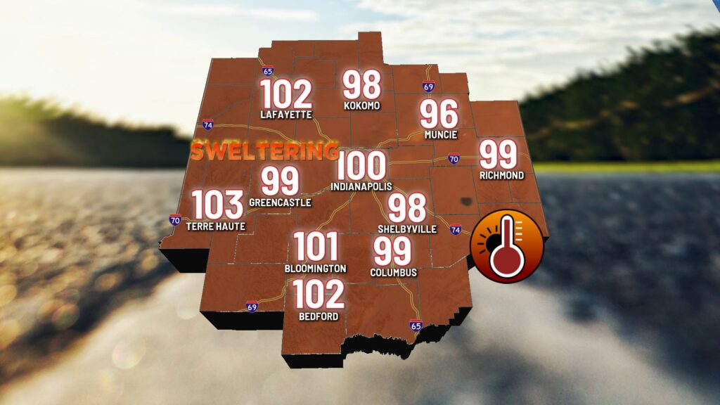
The main concern remains the heat. High temperatures will reach the mid-90s this afternoon, with heat indices well over 100°F for most areas.
Scattered storm chances will continue, especially along and north of I-70. Much like Saturday daytime hours, many areas may stay dry, but those that experience rain and storms could see heavy downpours, frequent lightning, and occasional stronger wind gusts. Overnight lows will fall to the mid-70s, making for an uncomfortable night.
Scattered showers and thunderstorms will again be possible on Sunday as we continue to monitor several waves of storms moving out of the northwestern portion of the Midwest.
Very hot temperatures will persist, with highs approaching the hottest of the season. Expect highs in the mid-90s and heat indices between 101°F and 105°F.
Monday will be equally hot and likely dry as the upper ridge shifts east. High temperatures will remain in the mid-90s, with heat indices as high as 105°F.
Midweek brings increased chances for thunderstorms as a cold front moves through the state, especially late Tuesday into early Wednesday.
Before any rain arrives, high temperatures will still reach the low 90s on Tuesday. Scattered showers and thunderstorms are expected Tuesday afternoon, continuing into Tuesday night and overnight.
A much-welcomed cooldown will follow the cold front. High temperatures will drop to the mid-80s on Wednesday, which is reasonable. We’re likely looking at lower 80s on Thursday and Friday, with comfortable overnight lows in the mid-60s and much lower humidity.

About The Author
You may also like
-
Four people shot, all stable, on northeast side of Indianapolis
-
History made during first round of LIV Golf Indianapolis
-
Indianapolis cemetery theft: 246 bronze vases stolen, some recovered
-
Kelsey Plum says she was joking about Caitlin Clark’s team at All-Star Game
-
Sweltering weekend with increasing rain/storm chances | Aug. 15, 2025