
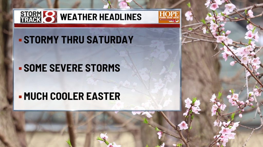
FRIDAY

Good Friday starts warm, breezy, and a little unsettled, but it is not a washout from start to finish. Expect a mostly cloudy sky with highs in the upper 70s, and a south southwest wind around 10 mph with gusts up to 20 mph. A few showers or storms may be around at times, especially late morning into early afternoon, then another round may try to fire later in the day. The bigger message is that this is a warm and humid setup for early April, so if you are traveling, try to stay weather aware through the afternoon and evening because a few storms could turn strong with gusty wind and some hail.
FRIDAY NIGHT

The weather stays active into the night, and this is the period where you will want to keep the radar close if you have late dinner plans, church events, or road time. Showers and thunderstorms remain likely, especially through the first half of the night, with lows only falling into the mid 60s. South wind around 5 to 10 mph with a few gusts near 20 mph. Rain will not be constant every minute, but when storms pass through they can drop a quick heavy burst and slow travel in a hurry, so give yourself a little extra time getting around.
SATURDAY
Saturday still leans unsettled, but it is one of those days where the weather comes in rounds rather than one nonstop rain shield. Highs reach the low 70s with a south wind around 10 to 15 mph and gusts up to the upper 20s. Showers and thunderstorms are likely, especially from morning into part of the afternoon, and some pockets of heavier rain are possible. It is not the cleanest day for Easter weekend travel, egg hunt prep, or outdoor errands, but there should still be breaks where you can work around the rain if you stay flexible.
SATURDAY NIGHT
Conditions finally begin to settle down some. A few leftover showers may linger early, then the night trends quieter and much cooler with lows around 40. West northwest wind around 10 mph with gusts up to 20 mph. You will notice the change pretty quickly after sunset, the warm spring feel fades, and by late night it feels much more like a typical early April night again.
SUNDAY
Easter Sunday looks a lot easier to work with. Skies turn partly sunny, highs reach the low 50s, and a west northwest wind around 10 to 15 mph with gusts up to the low 20s keeps the day feeling crisp but comfortable. It is cooler than the previous two days by a good margin, but the tradeoff is quieter weather and much smoother travel for church, brunch, and family visits.
SUNDAY NIGHT
The weekend closes on a calm note with partly cloudy skies and lows in the upper 30s. West wind around 5 mph. No real weather headaches here, just a cool, simple night that lets the holiday finish without any extra fuss.
7 DAY OUTLOOK

After the warm and stormy start to the weekend, the pattern turns quieter and noticeably cooler by Easter Sunday and into early next week. Highs fall from the 70s Friday and Saturday back into the 50s Sunday and Monday, with nights dropping into the 30s and a few mornings next week carrying at least some frost or freeze potential in colder spots. So the big picture is a classic spring swing, stormier and summerlike up front, then calmer and more seasonable once the weekend wraps up.