
Marcus’ 4 a.m. Tuesday forecast
INDIANAPOLIS (WISH) — A heat advisory remains in effect until 8 PM Tuesday.
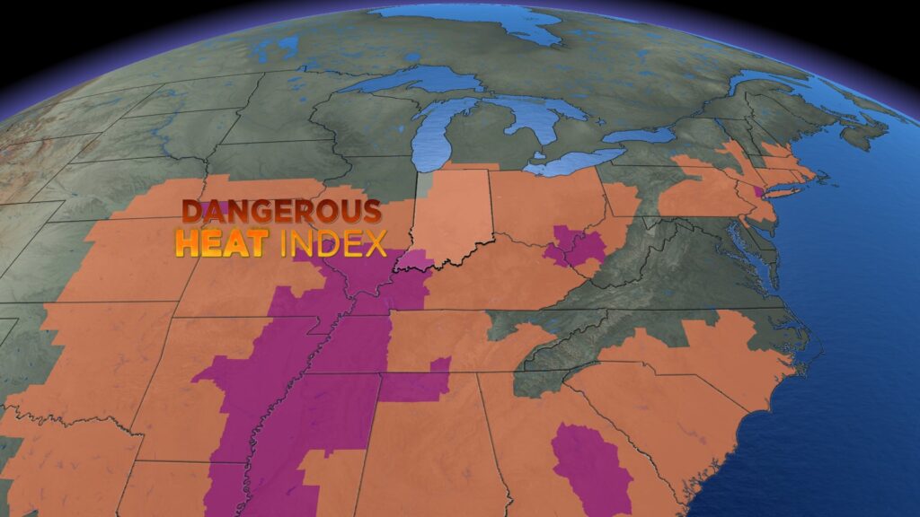
Today:
Areas of patchy fog have developed across Central Indiana this morning, especially in southern counties affected by heavy rain on Monday morning. The fog should lift quickly just after daybreak.
Hot and humid conditions will continue as an upper ridge dominates the Midwest. Precipitation chances are low, keeping conditions sunny, hot, and muggy this afternoon. High temperatures will reach the low to mid-90s, with heat indices potentially climbing to 105°F.


Wednesday:
Hot, humid, and mostly dry conditions are expected during the daytime hours on Wednesday. High temperatures will reach the lower 90s, with heat indices hovering around 100°F Wednesday afternoon.

Storm chances return:
A change is coming Wednesday night into Thursday. A cold front will bring showers and thunderstorms, with the potential for isolated severe wind gusts and localized flooding.

Much of the state is under a Level 1 out of 5 severe weather risk. Damaging winds will be the primary concern Wednesday night into Thursday morning.

Additionally, heavy rainfall in already saturated areas could lead to minor flooding concerns through Thursday.
Heat relief:
Scattered showers and thunderstorms should exit the region by late Thursday morning or early Thursday afternoon. A significant cooldown with falling humidity will follow. High temperatures will reach around 80°F on Thursday and may not reach the 80s on Friday or into the start of the weekend.
Dewpoint temperatures will also slide back to more comfortable levels, with very dry air settling in by the end of the weekend.

Overnight lows, which have been stuck in the 70s for the past few weeks, will become more pleasant. Expect lows to fall to the lower 60s starting Thursday night, with some areas possibly seeing lows dip into the mid to upper 50s Friday night into Saturday morning.
7 day forecast:
The long-range pattern suggests a return to the mid-80s, which is near normal for early August. Shower and thunderstorm chances should hold off until early next week.

About The Author
You may also like
-
Indianapolis on pace for one of the most humid summers on record
-
City of Carmel gives updates on construction projects
-
IMPD: Police shooting on west side of Indianapolis, officer and suspect shot
-
Kroger and union workers extend contract while negotiations continue
-
Man who lit IndyGo bus on fire ordered to pay $1.7 million and gets 8 years in prison