
Marcus’ 5 a.m. Friday forecast
INDIANAPOLIS (WISH) — Temperatures will be running nearly 10° below average this weekend with several rain opportunities through Sunday night.
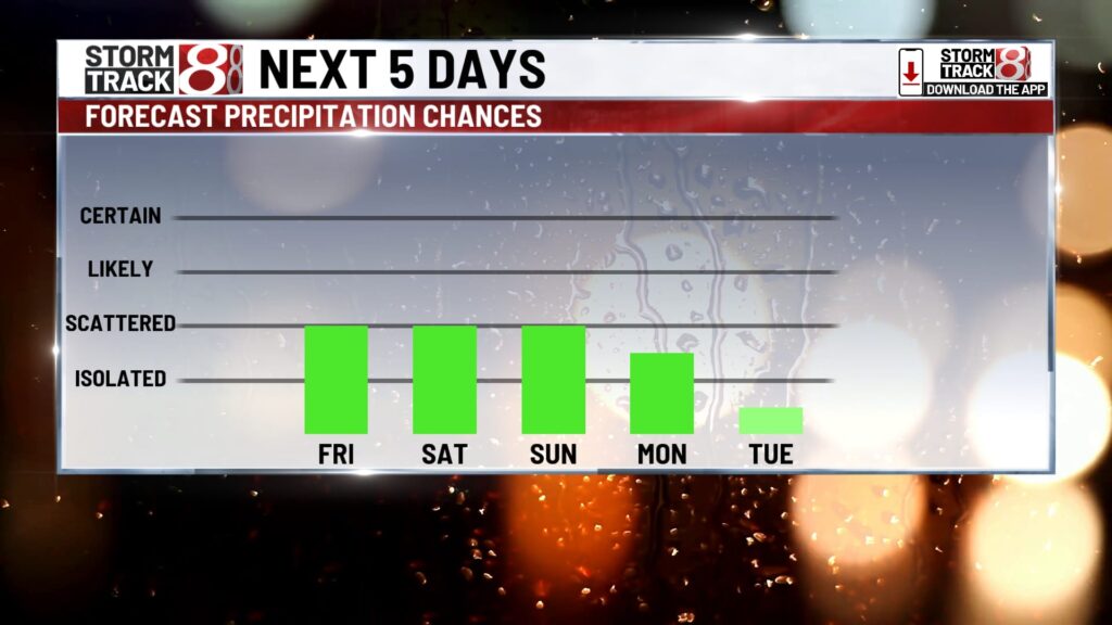
Friday:
We’re tracking a few scattered showers and isolated thunderstorms across Central Indiana this morning as a weak upper-level wave continues to push through the state. Scattered showers and thunderstorms are expected to persist through the morning commute. Not everyone will see rain, but a few locally heavy downpours could slow your morning drive.


A front will move through the state, bringing scattered showers and a few rumbles of thunder to central and southern portions. The heaviest rainfall, and possibly a few stronger thunderstorms, should remain along the Ohio River in southern and southeastern Indiana.
High temperatures will reach the low 70s.


Friday night:
Another surface wave will move along a stalled boundary just to our south, increasing rain chances, particularly in southern portions of the state.
Overnight lows will fall to the mid-50s.

This weekend:
The pattern will remain unsettled as a cutoff low develops over the Midwest this weekend, bringing numerous chances for showers and occasional rumbles of thunder on both Saturday and Sunday.
Due to cloud cover and rain, temperatures will be well below average for this time of year, reaching only the mid-60s on Saturday and struggling to climb out of the 50s on Sunday.

Rainfall amounts could exceed an inch in some locations due to the numerous rain chances this weekend.

Next week:
The upper-level low will linger into Monday, bringing scattered rain chances and cool temperatures throughout the day.
By Monday night, the low will begin to break down, gradually tapering off rain chances starting Tuesday. Temperatures should also warm up closer to average by Tuesday afternoon.

About The Author
You may also like
-
Indianapolis teen hosts event to help reduce youth violence
-
Colts WR Alec Pierce draws rave reviews from teammates, coaches
-
Residents of Indianapolis homeless camp scramble for new housing
-
Colts’ Michael Pittman Jr. puts Tyler Warren through off-field ‘test’
-
1 dies in 2-car collision on State Road 234 in northeast Hancock County