
Marcus’ 4 a.m. Thursday forecast
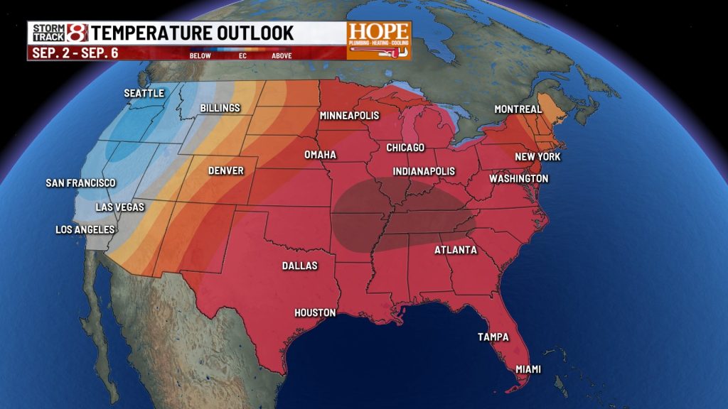
INDIANAPOLIS (WISH) — The stretch of pleasant late-summer weather continues across central Indiana through the start of the weekend, but a significant shift in the pattern is looming. A warming trend will push temperatures back into the 90s starting Sunday, accompanied by high humidity that will drive up the heat index for the first half of next week.
Today: Patchy Fog Gives Way to Sunshine
A quiet Thursday is ahead for central Indiana once early morning patchy fog dissipates. Expect mostly sunny skies through the morning, transitioning to a mix of sun and clouds this afternoon.
High temperatures will reach the lower to middle 80s.

Tonight:
Skies will remain clear tonight as dry air settles over the region. Overnight lows will drop into the lower to middle 60s. With light winds and low humidity, it remains an ideal night for natural ventilation before the heat returns.
Friday and Saturday:
The upcoming weekend starts on a high note. Friday and Saturday will feature mostly sunny skies as high pressure drifts to our east. This shift will transition our winds to the south, beginning the northward pull of warmer, more humid air.
Highs will top out in the low/mid 80s Friday. Humidity should remain low.
Saturday will be a more muggy day, but only slightly. Highs will top out in the mid 80s.
Sunday through Wednesday: High Heat and Humidity
The pattern shifts significantly Sunday as a ridge builds over the Midwest. Strong high pressure over the Deep South will pump tropical air into Indiana.
Expect highs to reach the lower to middle 90s daily from Sunday through Wednesday. When combined with dew points surging into the lower 70s, the heat index will likely approach the triple digits during peak afternoon heating.

We will likely stay dry through this period as well, with very limited rain chances over the next 7 days.

About The Author

You may also like
-
Lunar eclipse tonight, dry & warmer days ahead
-
Indianapolis man gets 12 years for Chase Bank robbery
-
Volunteers help rebuild 93-year-old man’s flood-destroyed home
-
Homeless woman arrested after infant found abandoned at shopping center
-
UPS employee arrested for theft of firearm in Vanderburgh County