
Marcus’ 4 a.m. Monday forecast
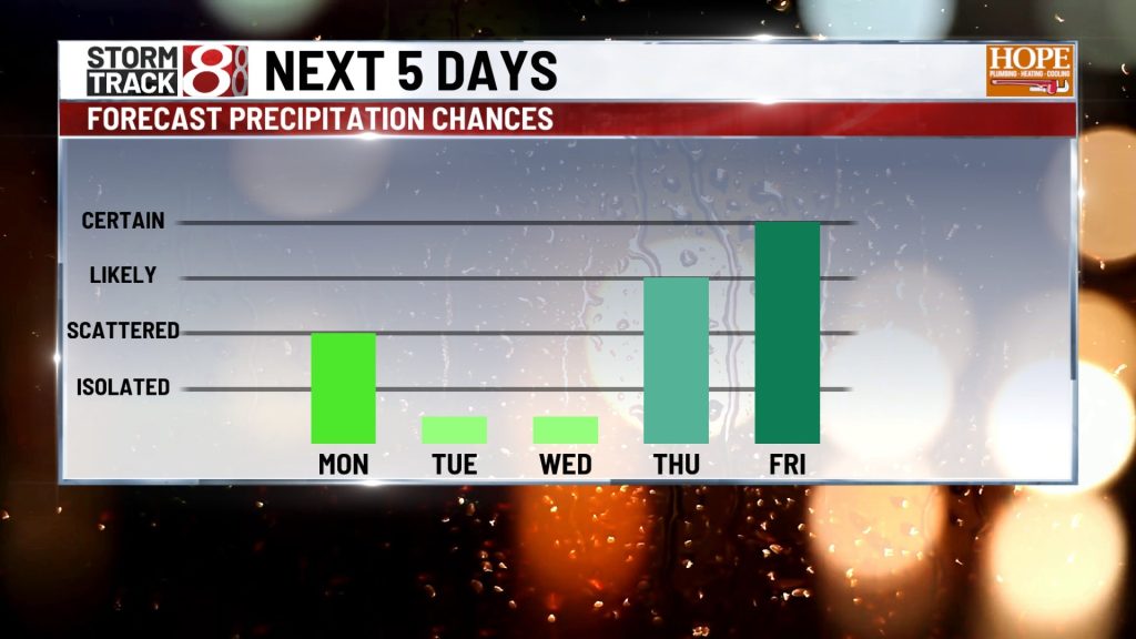
INDIANAPOLIS (WISH) — Central Indiana heads into another day of scattered showers and thunderstorms Monday, with eastern counties seeing the highest storm coverage. Slow-moving storms may lead to localized flooding before a brief drying period arrives Tuesday and Wednesday.
Late in the week, a stalled cold front will bring daily chances of showers and storms through the weekend.
Morning Conditions: Patchy Fog and Muggy Start
Expect patchy fog and low clouds developing early Monday across parts of central Indiana. Though fog won’t be as widespread as Sunday morning, visibility may still be reduced in spots, impacting the commute.
Afternoon and Evening Storms: A Few Heavy Downpours
A weak low-pressure system pushing east will sustain isolated to scattered showers and thunderstorms Monday, primarily over eastern Indiana.
Storm activity should peak between 3 p.m. and 10 p.m. The main threat is heavy rainfall and localized flooding due to slow-moving storms.

Tuesday to Wednesday: Brief Drying and Normal Temperatures
The storm system will exit Monday night. High pressure building from the north will bring drier air and reduce storm chances through Wednesday.
Tuesday will feature mostly sunny skies, with isolated storms possible in far southern counties only. Highs will climb to the mid- to upper 80s.

Wednesday will see weakening high pressure and a weak low over the lower Ohio Valley. Dry air should keep most of central Indiana dry, with only isolated afternoon storms near the Ohio River.

Late Week Pattern Change: Stalled Front Brings Daily Storms and Flood Risk
A notable pattern shift arrives Thursday as a cold front advances south into Indiana. The front is expected to stall over central Indiana and the Ohio Valley by Thursday or Friday, blocked by a high-pressure ridge over the Gulf Coast.

This stalled front will be a focus for repeated rounds of showers and thunderstorms from Thursday through Sunday.
Key Concerns:
- Tropical moisture streaming north along the front, combined with successive disturbances, will trigger daily storm clusters
- Though severe weather is not expected due to weak wind shear, localized wind gusts with strong storms remain possible
- Heavy rainfall and localized flooding will be the primary concerns, especially where storms “train” over the same locations
- High precipitation efficiency is likely

Temperatures will remain in the mid-80s, with dew points in the upper 60s to low 70s, maintaining muggy conditions.
Seven-Day Forecast

About The Author

You may also like
-
Man involved in far east side crash dies after being hit by second vehicle, police say
-
A doctor’s warning to stop weekend’s celebration from becoming emergency situations
-
1 person dead after west side I-465, I-74 crash
-
Man fatally shot on northeast side of Indianapolis
-
Missing 4-year-old boy found dead in Indianapolis on the 4th of July