
Storm chances moved through the region today, with quiet weather settling in this weekend.
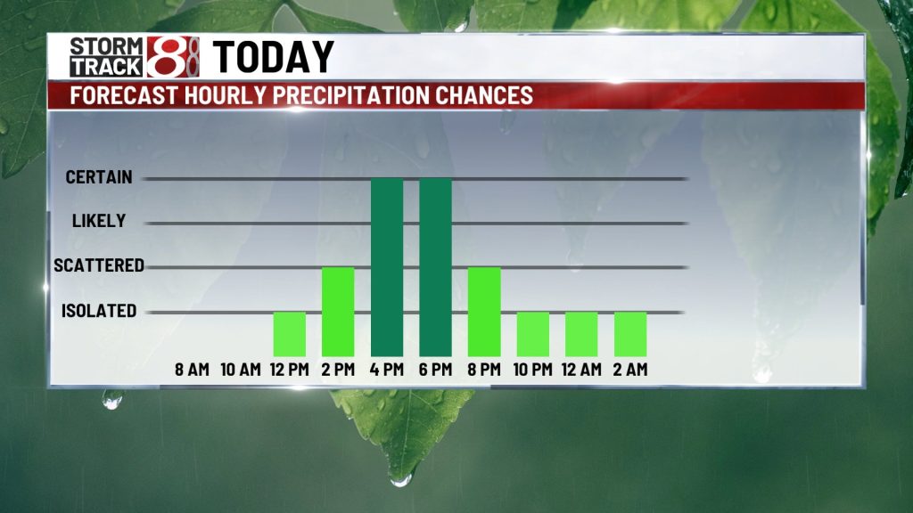
Showers and storms are possible today.
A cold front will approach from the west and bring increasing chances for showers and thunderstorms through the day. While isolated showers are possible this morning, better opportunities for rain and storms will arrive during the afternoon and evening hours.

While the overall severe threat is low, a few stronger storms could produce gusty winds and maybe some larger hail in very isolated spots. There is a level one out of five risk for severe storms across central and eastern Indiana this afternoon.

High temperatures will top out in the mid 70s this afternoon.

A quiet and comfortable weekend is ahead.
Once the cold front moves through late tonight, rain and cloud cover will slowly exit the area. Both Saturday and Sunday look dry and comfortable with mostly sunny skies. High temperatures will top out in the mid 70s.

Severe weather threat returns Monday.
A more significant storm system will arrive Monday into Monday night, pulling warm, humid air into the state. This will create an environment supportive of severe storms, with all modes of severe weather possible.

High temperatures will top out in the lower 80s.
Once the system moves out Monday, rain chances will continue for the middle of the week, and temperatures will cool to near or slightly below average.

About The Author
You may also like
-
Fernando Mendoza, Omar Cooper Jr. make IU football history
-
Indiana audit of Medicaid attendant care program flags widespread violations
-
Charges filed after HSE bus driver caught drinking vodka from juice bottle while driving
-
At least 10 people injured in shooting at Louisiana mall
-
Man sentenced to 55 years for strangling cellmate in Marion County jail