
Marcus’ 4 a.m. Thursday forecast
INDIANAPOLIS (WISH) — Our active stretch of weather continues this week, with strong winds today and multiple rounds of storms through the start of the weekend.
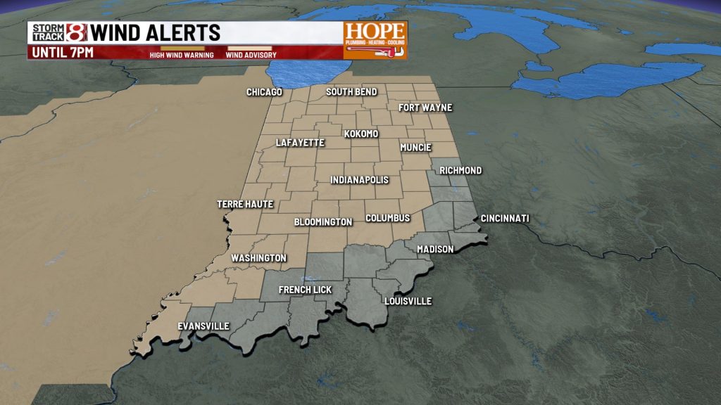
**Wind Advisory Today**
Strong, gusty winds will develop as much of central Indiana moves into very warm air. Wind gusts are expected to hit 45 to 50 mph during the afternoon hours. The wind advisory will remain in effect until 7 PM across central Indiana.

Meanwhile, much of the day will be relatively quiet, with only isolated showers and storms possible in the morning. High temperatures will top out near 80°.


**Strong Storms Possible Tonight**
Storm chances will ramp up again late today into tonight as a line of thunderstorms moves in from Illinois. Much of central Indiana is under a Level 1 (out of 5) risk for severe weather, with damaging winds as the primary threat. There is also the potential for large hail and a brief tornado. The severe threat will likely end by late tonight.
**Storms Continue Friday into Saturday**
Chances for showers and thunderstorms will continue on and off through Friday. Additionally, some strong storms are possible during the afternoon and evening hours, with damaging winds and large hail as the primary concerns.
High temperatures will top out in the mid-70s Friday afternoon.
A stronger cold front will move through the region on Saturday, bringing widespread showers and storms with the potential for heavy rainfall. There is also a chance for some strong to severe thunderstorms, along with gusty winds reaching up to 40 to 45 mph.
**Cool Down This Weekend**
Once the cold front moves through on Saturday, a big shift in temperatures will arrive heading into Easter Sunday. Rain chances will move out Saturday night as cooler and drier air settles in. Early morning temperatures on Sunday will be just above freezing, with highs likely only reaching the mid-50s by Sunday afternoon.
Temperatures will remain slightly below average Monday into Tuesday of next week, with highs in the mid to upper 50s. We’ll top out close to 60° by the middle of next week.
About The Author
You may also like
-
IMPD nabs 18 in near north side drug investigation
-
Higher ed commission approves consolidation, elimination of hundreds of degrees
-
Trump speaks about war with Iran amid rising oil prices
-
4 astronauts rocket into space in first trip to the moon in more than 53 years
-
Sam’s Club is raising its membership prices in May