
Marcus’ 4 a.m. Wednesday forecast
INDIANAPOLIS (WISH) – The big chill returns with scattered snow showers and much colder temperatures settling in starting today.
Today:
As a cold front moves in, temperatures will steadily decline throughout the day. Winds from the northwest will intensify, with gusts potentially reaching up to 35 mph, making the temperature feel even colder.

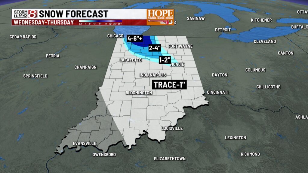
Scattered snow showers are expected to develop as the colder air takes hold. Some locations may see snow mixing with rain early on, but most areas will transition fully to snow, leading to minor accumulations of about a dusting to a half inch. However, a lake-enhanced snow band may form, bringing localized totals of one to two inches where it persists. This may fluctuate over northern portions of the state, but could include areas like Kokomo, Muncie, and Marion


Late week:
Thursday night into Friday may bring additional light accumulating snow as another weak weather system moves through the region. Areas could see similar totals of one to two inches as the cold air quickly returns behind this system.
Cold temperatures are projected to linger through the weekend, with highs in the teens to low 20s. The coldest day is anticipated to be Sunday, when wind chills could dip below zero at times. Additionally, light snow or snow showers might occur, but significant accumulations are not expected.
7 day forecast:
Cold air looks to settle in for the extended period, with highs running about 15° below average to kick off next week.

About The Author
You may also like
-
Advocates warn Trump administration moves could roll back disability rights
-
‘I’m in danger’: Court docs detail how an unruly passenger forced an emergency landing at IND airport
-
Butler’s iconic Hinkle Fieldhouse will play host to the next NBA Cup final in December
-
IAA: Passenger detained after ‘causing disturbance’ on United Airlines flight out of Indianapolis
-
Multi-agency drug patrol in Indiana leads to 73 arrests, 150+ charges