
August 21, 2025 morning forecast with Tara Hastings
INDIANAPOLIS (WISH) – Cooler conditions for the day today with some clouds around. We warn back up a little bit closer to normal for the first part of the weekend and then the temperatures plummet for early next week. It will feel much more like fall across parts of the state heading into early next week.
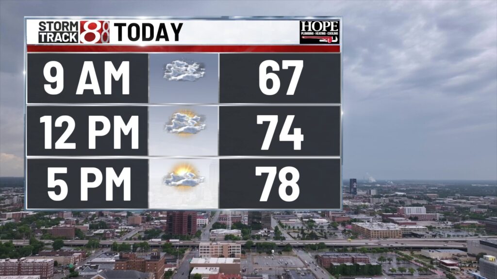
TODAY: A few spotty sprinkles and areas of drizzle this morning under mostly cloudy skies. We will see lower humidity values throughout the day today and cooler temperatures. Lots of clouds in place today with a wind out of the north will keep our temperatures into the ’70s today. High’s right around 78. Normal high temperature for this time of year is around 84.


TONIGHT: Sky’s become partly cloudy overnight tonight We will see low temperatures falling to 64.

TOMORROW: Mostly sunny skies heading into your Friday with high temperatures into the lower ’80s. Humidity values are still relatively low. Zone forecast looks to be dry on Friday night as well if you are heading to any of those high school football games. Temperatures will be into the ’70s at kickoff.


7 DAY EXTENDED FORECAST: Sunshine for your Saturday humidity values climb a little bit during the afternoon. High temperatures right around 85 which is near normal for this time of year. Saturday evening a cold front pushes through and that will usher in cooler and much less humid air across the entire state. Over partly cloudy skies on Sunday highs near 79.


Temperatures stay into the middle 70s on Monday and Tuesday. Morning low temperatures will fall into the lower 50s across much of the state.

Quick look at hurricane Erin. We do have the category 2 storm that will continue to move out into the Atlantic. Although it will not technically make landfall on the East Coast it will produce some really high surf and gusty winds along the east coast.

About The Author
You may also like
-
$1B Google data center moves forward despite local opposition
-
Powerball jackpot soars to $700 million
-
Seasonally cool temperatures have arrived in central Indiana | Aug. 21, 2025
-
UPS ‘saddened’ after employee fatally shot outside logistics facility
-
Man sentenced to 38 years for drive-by shooting in Columbus park