
Marcus’ 4 a.m. Thursday forecast
INDIANAPOLIS (WISH) — Temperatures will remain below average through the weekend.
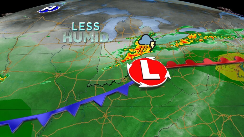
Today:
Scattered showers and thunderstorms will continue this morning as a cold front moves across the state. Expect locally heavy rain and frequent lightning through the morning and early afternoon.

Rain should clear by the afternoon, leaving mostly cloudy skies and significantly cooler temperatures later today. High temperatures, likely already reached in the mid to upper 70s during the overnight hours, will hover in the low to mid 70s this afternoon.

Tonight:
Clouds will decrease overnight, with very pleasant temperatures. Overnight lows will drop to the upper 50s and lower 60s.
Pleasant weather settles in:
Expect an absolutely beautiful stretch of weather for Friday and the weekend.
Friday afternoon will feature mostly sunny skies, cooler temperatures, and much lower humidity. High temperatures will reach the upper 70s to lower 80s.
Similar conditions are expected for Saturday and Sunday, with sunshine, calm weather, and low humidity. High temperatures will hover around 80°F both days.
As an added bonus, overnight lows will slide to the mid to upper 50s for the weekend—the coolest in several weeks.
7 day forecast:
Next week, temperatures will begin to return to near-normal levels as an area of high pressure moves east, bringing a southerly flow. This will not only warm us up but also increase humidity, with isolated to scattered rain chances starting Monday afternoon. High temperatures will reach the mid 80s through Wednesday of next week.

About The Author
You may also like
-
New name, expanded mission: EightDown Festival celebrates Black business and culture
-
Trump demands drug companies cut prices within 60 days
-
Epstein accuser’s family expresses shock over Trump saying Epstein ‘stole’ her
-
Indiana Fever sign Chloe Bibby for rest of season
-
IFD responds to fire near Fashion Mall at Keystone