
Marcus’ 4 a.m. Wednesday forecast
INDIANAPOLIS (WISH) — After a brief break from the high humidity, hot and humid conditions return to central Indiana for much of the extended forecast.
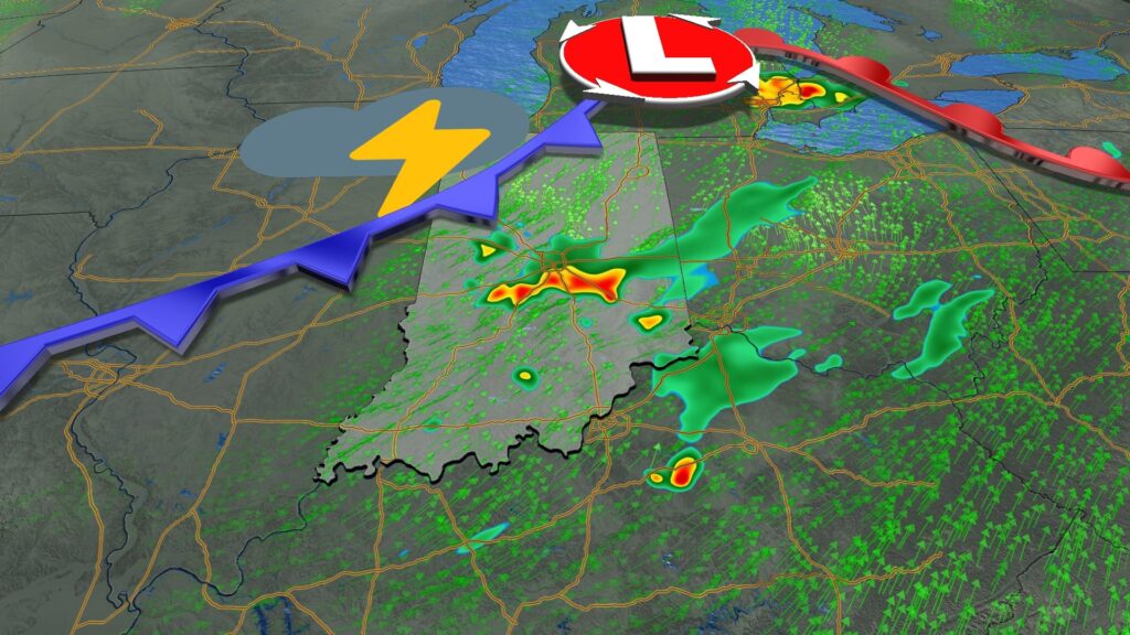
Today:
Scattered showers are moving across the northern portions of our state this morning. They should start to fizzle out over the next few hours, leaving us mostly quiet and dry through around lunchtime.
An upper-level disturbance will move through the region this afternoon. With increased humidity and unstable air, scattered showers and thunderstorms are likely to develop during the peak heating of the afternoon, especially in the southeastern portions of the state. Brief, localized heavy rainfall and frequent lightning will be the main concerns with any storms that develop today. Overall, conditions should remain mostly dry as we head into the afternoon.


Tonight:
Scattered showers and thunderstorms will gradually move east through the early to mid-evening hours as a weak area of high pressure expands across the Midwest. Expect mostly cloudy to partly cloudy skies overnight with lows hovering around 70°F.
Thursday:
Patchy fog will be possible Thursday morning with relatively quiet conditions and calm winds. Otherwise, expect a calm day with sunny skies, warm temperatures, and muggy conditions, with only a stray pop-up thunderstorm possible in the afternoon. High temperatures will reach the mid to upper 80s.
Friday:
Friday should start quietly in the morning, with scattered showers and thunderstorms developing in the afternoon. As with recent days, heavy rainfall is possible with any storms that develop. There are also indications that stronger wind gusts could occur with storms that form Friday afternoon.
High temperatures will reach near 90°F, with feels-like temperatures in the upper 90s Friday afternoon.
This weekend:
Saturday will offer the best chance for rain in the extended period. Light showers are possible Saturday morning with a lingering wave moving through. A cold front sliding by during the afternoon will bring the best chance for widespread showers and thunderstorms across the area.

Sunday will also bring rain chances but with less coverage than expected on Saturday. High temperatures will be in the mid to upper 80s both days this weekend.
7 day forecast:
Our typical July pattern continues early next week with near-normal temperatures, high humidity, and nearly daily pop-up afternoon storms. Some trends suggest temperatures could warm into the 90s by the middle of next week.

About The Author
You may also like
-
Indianapolis teen hosts event to help reduce youth violence
-
Colts WR Alec Pierce draws rave reviews from teammates, coaches
-
Residents of Indianapolis homeless camp scramble for new housing
-
Colts’ Michael Pittman Jr. puts Tyler Warren through off-field ‘test’
-
1 dies in 2-car collision on State Road 234 in northeast Hancock County