
Marcus’ 4 a.m. Monday forecast
INDIANAPOLIS (WISH) — Heavy downpours will be possible later today.
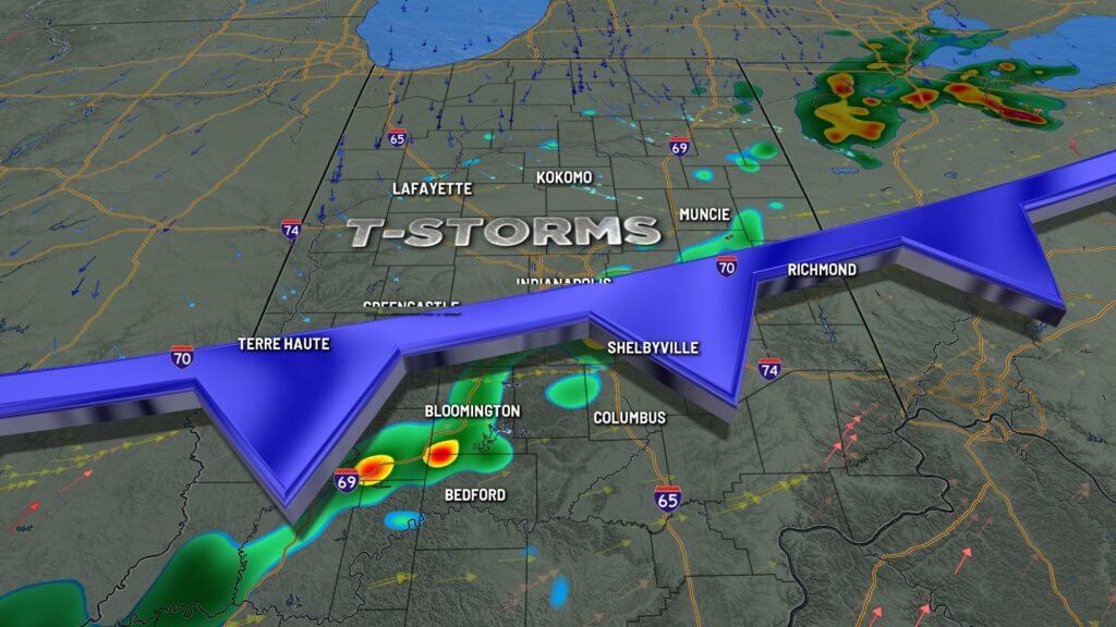
Today:
The frontal boundary that triggered storms in parts of the area on Sunday is slowly moving into the far northern portions of Central Indiana this morning. As the front moves south and daytime heating increases, expect scattered showers and thunderstorms to develop along the boundary in central and southern Indiana, possibly as early as late morning but more likely in the early to mid-afternoon.
Severe weather is not expected, but heavy downpours are possible as the storms will be highly saturated and slow-moving, potentially dumping significant rain in a short time.
High temperatures will be slightly below average, reaching the low to mid-80s.

Tonight:
Thunderstorms will move southeast of the area by early evening. A weak area of high pressure will settle in overnight, clearing the skies. Lows will drop to the upper 60s.
Tuesday:
Tuesday looks relatively quiet as high pressure lingers, keeping skies sunny. Temperatures will be slightly warmer, reaching the mid to upper 80s. High humidity will persist, with dewpoint temperatures around 70°F.
An upper-level wave will move through the region late Tuesday night, increasing the chances of showers and thunderstorms across the area into Wednesday morning.
Wednesday:
A second round of storms is possible Wednesday afternoon. While severe weather isn’t expected this week, heavy rain, frequent lightning, and brief periods of strong winds are possible.
The primary concern is that areas experiencing multiple thunderstorms during the day face a higher risk of flash flooding due to heavy precipitation.
High temperatures on Wednesday will reach the mid-80s.
7 day forecast:
The rest of the workweek will be similar to Wednesday, with partly cloudy skies, seasonable temperatures, humid conditions, and bouts of showers and thunderstorms as several waves move through on Thursday and Friday. Severe thunderstorms are not expected, but torrential downpours are possible. Highs will reach the mid-80s on Thursday and approach 90°F on Friday.

Heading into the weekend, a frontal boundary approaching the state will bring a better chance of showers and storms from Friday night into Saturday, resulting in more widespread showers and thunderstorms. Some lingering showers and thunderstorms may persist into Sunday. Weekend temperatures will remain seasonable, topping out in the mid-80s.

About The Author
You may also like
-
Youth mentors say curfew proposal could work but not a cure-all
-
Supreme Court clears the way for Trump’s plans to downsize the federal workforce
-
Italy outraged after heroic police dog found dead after eating food laced with nails
-
Ganggang’s The Kickback series brings joy, music to Indy’s near westside
-
Anderson man sentenced to 45 years for brutal attack on neighbor