May 20, 2025 morning forecast with Tara Hastings
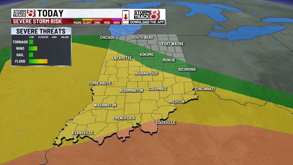
INDIANAPOLIS (WISH) – Moderate to heavy rain for the first part of the day today. A little break and then another round of showers and thunderstorms some of those could be on the stronger side later this afternoon into the early evening hours.
TODAY: Soggy situation heading into your Tuesday. Moderates a heavy rain this morning with a few areas hearing some thunder and seeing some lightning. Another round of thunderstorms will develop later this afternoon into the early evening hours. Some of these thunderstorms could be on the stronger side with the main threat being very gusty winds. There may be enough rotation that we could see a quick spin up of a tornado or a little bit of hail as well. Will look for high temperatures today to stay into the 60s for Central Indiana 70s across parts of Southern Indiana. We will see non thunderstorm wind gusts around 20 mph later this afternoon.


TONIGHT: Showers and thunderstorms, some on the stronger side mainly between 2:00 p.m. and 9:00 p.m. The thunderstorms eventually come to an end after midnight and we stay with mostly cloudy skies. Low temperatures fall right around 60.


TOMORROW: Lots of clouds for your Wednesday a few spotty showers could be possible on and off throughout the day but nothing heavy. It will be cooler with high temperatures only around the mid 60s.


THURSDAY: Mostly cloudy skies on Thursday still a few spotty showers possible. It looks like this day will be the coldest day of the work week with highs only around 60.

7 DAY EXTENDED FORECAST: We dry out for Friday under partly cloudy skies. Still a bit cooler with highs right around 64.
Race weekend looks to be dry on Saturday with sunny skies. High temperatures climbing into the upper 60s.
On Sunday we’re keeping a close eye on rain chances . Right now it looks like rain will stay in the southern sections of the state.

About The Author
You may also like
-
Possible reorganization of northern Hamilton County township sparks debate
-
Hamilton County BZA denies Aypa Power’s battery storage project
-
Caitlin Clark to miss fourth straight game on Sunday
-
Notre Dame study reveals PFAS in reusable feminine hygiene products
-
Multiple people stabbed at Michigan Walmart; suspect arrested

