
July 18 | Evening Forecast with Chief Meteorologist Keith Gibson
INDIANAPOLIS (WISH) — Prepare for an active and swampy weekend with several rounds of showers and storms. This will include risks for flooding and severe storms.
Friday night: We look to increase rain chances closer to the pre-dawn hours of Saturday. Lows in the low 70s.
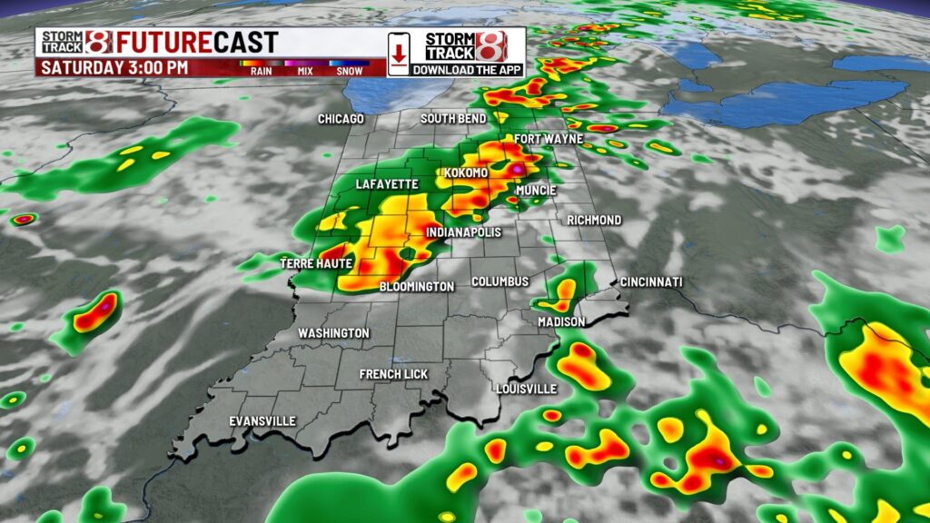
Saturday: We are gearing up for several rounds of activity this weekend that gives way to flood/severe risks beginning Saturday morning. Mid 70s dew points + increasing dynamics aloft are leading to this active pattern. Rainfall rates within the heavier downpours will be up to 1-2″ per hour, which could cause some localized flash flooding.
Pinpointing exact timing is still difficult. There looks to likely be scattered showers/storms in our area Saturday morning before a storm complex rolls in Saturday afternoon-evening. Additional development may occur late Saturday night into early Sunday morning.


A level 2/5 slight risk is in place due to the Saturday afternoon-evening complex for a threat of damaging winds, and there could be some embedded rotation at times.

Highs in the mid 80s with feels like temperatures pushing the mid 90s.

Sunday: Additional development may occur at times throughout Sunday with very muggy air persisting. There is also a low level 1/5 severe risk for damaging winds. Flooding concerns will remain prevalent with highs in the mid 80s.

7-Day Forecast: Rain and storm chances remain elevated through Monday before a hot dome begins to take over the area. This dome will bring us sweltering heat and humidity into mid to late next week and reduce rain/storm chances to isolated pop-ups. Highs look to soar into the low to mid 90s with heat index values over 100. At this point, we’re likely heading towards heat alert territory.


About The Author
You may also like
-
Vehicle drives into crowd in East Hollywood, injuring more than 20 people
-
New Greenwood venue by Mad Hatter Shows to open in August
-
Indiana Black Expo Summer Celebration kicks off in Indianapolis
-
Indiana Grown: Sugar Creek Lavender Farm
-
Hartbeat and Pacers team up for Fever Fest at WNBA All-Star 2025